Distance: 4.64 miles round trip
Walk duration: 2 hours
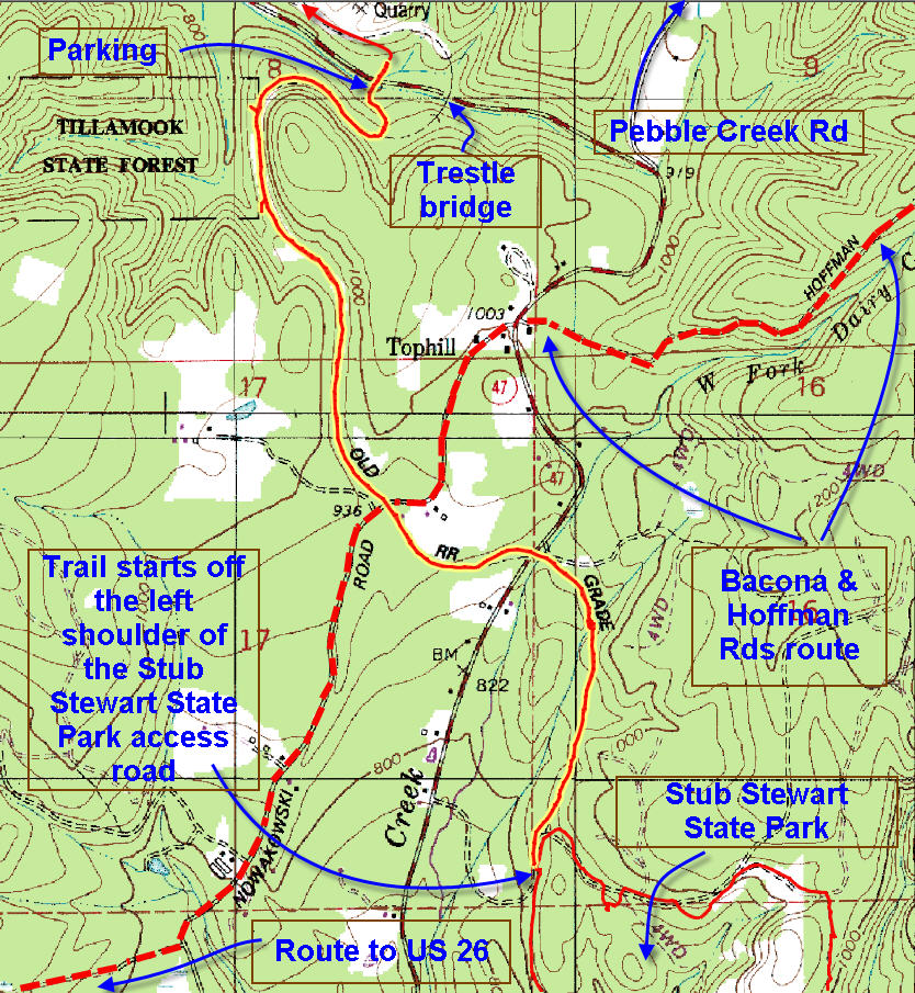
Travel time to trail head: From the Sylvan interchange on US 26 (top of the West Hills) take the Sunset Highway (US26) west for 25.3 miles and turn right onto US 47 headed towards Vernonia. Follow US 47 for 4.1 miles and turn into the Stub Stewart State Park. The park access road crosses the Banks-Vernonia trail about 1/3 of a mile from US 47. Park wherever you can – you may want to proceed up to the Park’s administrative building and then return to the trail crossing. The trail we will be following drops off the left hand side of the roadway.
Elevation change: 185 feet in 4.6 miles. The high point of the walk is just west of Tophill (approximately 1000 ft.) where the trail crests the hills before descending down to the Nehalem valley highway (US47).
Trail Log: This portion of the Banks to Vernonia Trail begins by 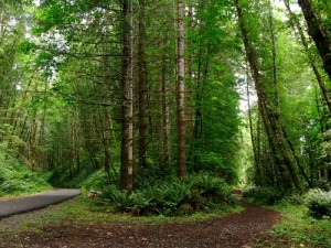 dropping off the left hand should of the Stub Stewart State Park access road (about 1/3 miles form the entrance on US 47. From there the route follows generally straight route north traversing the wooded hillside at the western boundary of the park. A number of trails from the park connect with the linear trail in this section, including the Horseshoe trail.
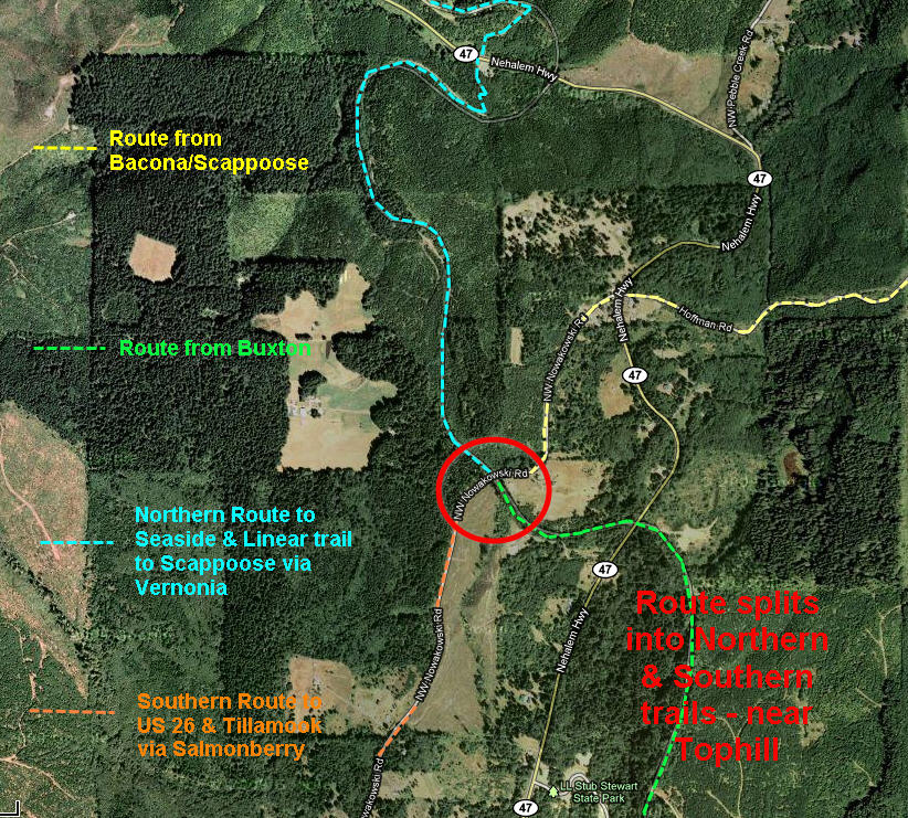
About 3/4 mile from the start of this segment the route crosses a creek and begins to bend to the left (westerly direction). Soon it passes over the Nehalem Highway (US47) on a narrow footbridge.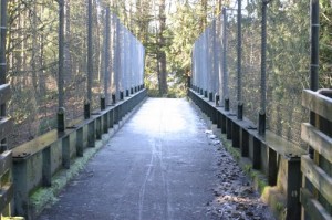 A third of amile onwards the trail crosses NW Nowakowski Road – which is a very important junction in the network of route I have surveyed – the split between the Northern and Southern routes. This junction occurs where this trail segment crosses the NW Nowakowski Road. The route coming from Scappoose via Bacon crosses US 47 at Tophill and approaches this crossing from the NE. The Trail from Buxton and Stub Stewart State Park will approach the crossing from the SE. Coming from the Northwest quadrant will be the route that heads north to Vernonia and also connects to the trails headed west to Seaside. And taking NW Nowakowski Road south will provide the connections to US 26 , Timber and the Southern Routes to the coast via the Salmonberry River.
On this trail segment we will proceed across NW Nowakowski Road and follow the Banks-Vernonia trail uphill to where it crests the range that separates the 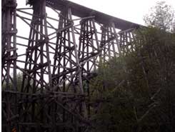 Nehalem valley from the Tualatin valley – at about 1000 ft. in elevation.
From here the road descends rather quickly circling a knoll that rises to the northwest of Tophill and then quickly drops almost 200 ft. in elevation to reach the Nehalem Highway just north of where it passes under an impressive railroad trestle that towers over the highway.
This trestle is also of significance geologically because the cliffs at either end of the trestle harbor rich fossil deposits from the Oligocene Era, including fossil crinoids. This is one of 12 sites noted in a 1957 DOGAMI report on fossil bearing locations around the Sunset Highway.
Reaching US 47 just north of the trestle, we have climbed out of the Tualatin River watershed and into the Nehalem watershed. When have crested the hill at Tophill we moved from the home territory of the Calapooya Indians in the Tualatin river basin into the remote valleys of the Upper Nehalem and Clatskanie River that were the home of the Clatskanie Indians. The Clatskanie Indians were mainly hunters, but they also benefited from the active salmon runs on both the Clatkanie and Nehalem Rivers and the abundance of berries on the hillsides. In order to keep grass growing on mountainsides for deer and elk, the Indians regularly burned trees and brush every few years.
The Clatskanie had a fierce reputation for being a violent tribe and they appear to have forced tribute from travelers passing through their stretch of the Lower Columbia . The men of the Hudson Bay Company that established the first outposts on Sauvie Island considered them so dangerous that they would not pass down the Columbia in armed groups of less than 60 men. Indeed, it is also reported that the Clatskanie’s had planned to attack Lewis and Clark in Fort Clatsop, but were thwarted at the last minute by the Clatsops that came to the explorers’ rescue. In 1810, Captain Nathan Winship tried to established the first settlement in Columbia County, but attacks by the unfriendly Clatskanie’s, as well as flooding forced him out. Originally numbering around 3,000, the first settlers that entered the Nehalem Valley and the Westport area found Chief Chewan presiding over a community of several hundred Clatskanie. Soon thereafter, epidemics reduced their numbers into the single digits and the survivors fled north to be adopted by another tribe.
The word “Clatskanai” was used by these Indians to signify a route alongside “swift running water” that they used to traverse their territory. The fact that the path might parallel several different swiftly flowing streams including both the Nehalem and the Clatskanie River seems to have eluded the Caucasian mapmakers. Which is why there is another river near Astoria by the similar name of “Klaskanine River” – which was actually the western end of the same Indian thoroughfare.
There is some evidence that the Calapooyans did venture north through these mountains to hunt and gather berries and even occasionally descended westward into the territory of the Wahkiakum Indians whose territory bordered the Clatskanie lands on the west. Reports suggest that the Wahkaikums, who lived around Gray’s Bay on the north shore of the Columbia and controlled several river islands and a band of land about 20 miles deep into the northern Coast Range, had reached an accommodation with the Calapooyans that allowed them to hunt seals in the Lower Columbia River.

Great article.