 Distance: 2.57 miles round trip
Walk duration: 1 hours 40 minutes
Travel time to trail head: 40 minutes
Driving directions to the trailhead: Driving directions to the trailhead: From downtown Portland drive north on US 30 past Linnton, Burlington, the Cornelius Pass intersection and Logie Trail. Continue past the Wildwood Golf Course, and exit Highway 30 at Rocky Point Road. Drive up Rocky Point road to the intersection with Skyline Boulevard, and continue straight onto Dixie Road. This road will take you north around the low summit of Dixie Mountain. At 1.4 miles the paved road ends and splits. The left hand option is Dixie Mountain Road that heads into Washington County. Take the right hand option which confusingly is also called Dixie Mountain Road and proceed another 1.9 miles. At this point you will pass a “blue gate” on the left hand side of the road. This is the trail head for the Pottratz Road Loop.
Elevation change: highest elevation 1593 feet; lowest 1153 feet crossing a tributary of McKay Creek
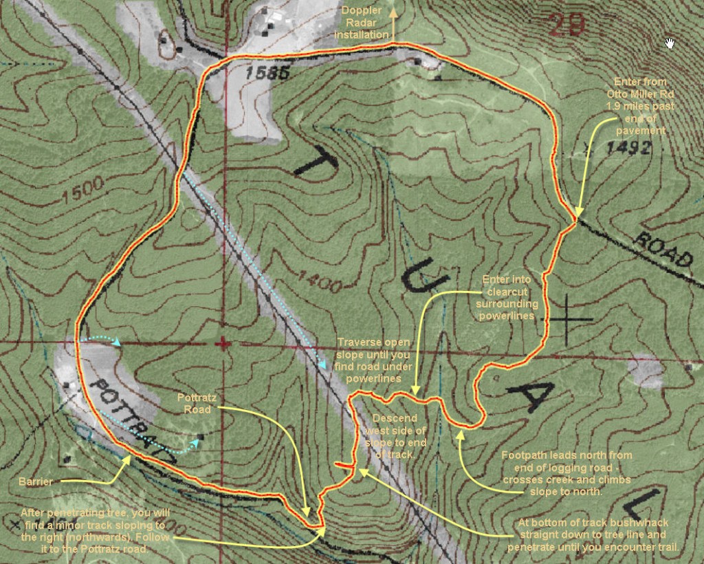
Conditions: The first part of the trail is an older forest logging road. That is followed by a narrow footpath that crosses the creek and ascends a clearcut slope alongside the High Voltage Power lines. Ascending the slope is essentially a bushwhack as the track gets lost since the the elk and deer use alternate routes – given the open landscape. Under the power lines a vehicular track prevails, but we leave that when bushwhack into the tree line to the west of the power lines – until we reach the small track that leads down to Pottratz Road. Pottratz road itself is not heavily graveled but sufficiently maintained to avoid large mud holes and boggy conditions. Beyond the barrier it is well graveled up to the junction with otto Miller Road.
Brief summary: This walk drops off the western flank of the Tualatin Hills and connects with an older road, Pottratz Road, to make an accessible and relatively short loop. It affords nice views of the western slopes, and it connects to a series of trails that crisscross the western slopes as far north as Buck Mountain. Pottratz Road was an integral part of the Dixie Mountain community in earlier days.
Trail directions:
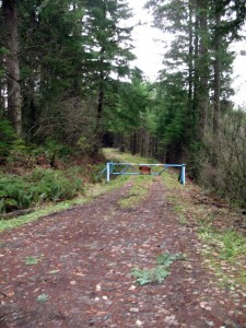
This trail begins at Otto Miller road – about 1.9 miles from where the pavement ends. As you drive through this section of older trees you will spot a “blue gate” just as the road turns to the right and begins to leave the cover of the conifer canopy.
The initial portion of this walk is a gently sloping track that leads down into the forest as it winds down through the thick young conifer forest. On the way you will pass a spur trail on your right, but continue to follow the main trails (left) down into the McKay Creek watershed. This initial portion of the hike is just under a half mile, and the elevation loss is about 118 feet.
At the end of the trail a small footpath continues onwards through a marshy area before ascending the slope on the north shore. The trail gets a bit harder to spot as it comes out of the trees and enters the clear cut area. Not to worry! Just pick your way up to the fairly open lansdscape (.10 mile) to the crest of the hill (1300 ft) and you will come across the road that runs along the power lines. For reference the powerlines are running in a Southeasterly direction at this point.
Follow the road that follow the power lines to your left for less than a tenth of a mile and you will see that a side trail heads down the other (south, southwestern) side of the hill. Follow this track down as far as it reaches. It stops about 100 feet above the tree line that marks the bottom of the clear cut.Even though the track ends at this point, we will continue walking down through the cleared area and into the trees below the power lines. These trees are thick and you will have to pick your way through as best you can, but the good news is that a primitive “skidder road” runs parallel to the cleared area about 25 feet below the edge of  the trees. So no matter where you descend you will encounter this road not long after you penetrate the woods. Once you reach this “skidder road” follow it to the right (northwards) and it will eventually lead you to Pottratz Road – a dirt track at this point.
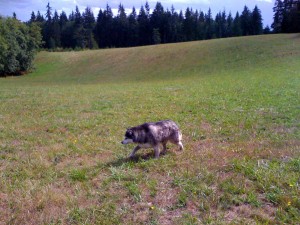
Loki loved romping through these high pastures stalking for moles.
Follow Pottratz road uphill to the north. On your left will be a small creek, and on your right will be occaisinal tracks leading up to the powerlines. Stay on Pottratz rd. Eventually you will pass a barrier that prevents cars from passing through. Two residences are located nearby as you leave the forest and walk through upland pastures. Now the road curves eastward and passes under the powerlines. Just beyond that
Pottratz road intersects with the Otto Miller Road that runs along the crest of this range. A sign at the intersection declares that Pottratz road is a dead-end and stops after .07 miles. This intersection is the highest point on the hike at 1590 ft.
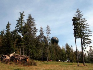
On the hill top to the east of Otto Miller road you will observe a giant “soccer ball” that is mounted above all obstructions. This is the Doppler rader that you will hear the meteorologists refer to when they’re pinpointing the rain. Turn right and follow the road back down 2/3 of a mile to where you parked the car.


hi
could not find potrratz road and had to turn back.
Guessing now the instructions mean keep going up and over the hill when you get to the powerline.
oh well
Note, the access off of Dixie Mountain Rd at the blue gate shown is logged and much of this is on PRIVATE PROPERTY. It’s not Otto Miller Rd. That is further north from the NW corner of the trail shown on the map.
Thanks for the explanation.
This site shows property ownership. It looks like Pottratz Road cuts across several private properties, though maybe there is a road right of way.
https://www.acrevalue.com/map/OR/?lat=45.707923&lng=-122.961773&zoom=15
Note: This site requires you to sign up but it is free.
Idk why you people try this is all private property and only the people who live around here have access too but still you all come hike and bike you may not run into someone you don’t want to run into. still you come are mountain has turned into a place for city people to disturb we all purchased are land to have peace and quiet and here we are getting intruded upon ♀️Just saying
So the next time you benefit from a nearby urban center by shopping, using the hospital, eating out, educating your kids, etc. recognize that these are services that wouldn’t be available to you were it not for the “city folks”. They should observe the privacy of private land, but there’s no reason they shouldn’t be using the public right of ways – which they also pay for.
In the past it took an entire day to get from Dixie Mountain to town. Today it takes less than an hour on roads mostly paid for by city folks. In the past the only cash crops you could grow were strawberries, now you sell Xmass trees and commute to a wide range of jobs, and your land values have risen dramatically. Do you really want to go back to when Rocky Point Road was so bad you needed a team of horses to pull your cars back up the hill?
While you’re absolutely right about not trespassing, putting up with folks that want to enjoy nature on the week ends is a small price to pay for the many essential services you receive thanks to the taxes paid by your city neighbors.
Jim Thayer