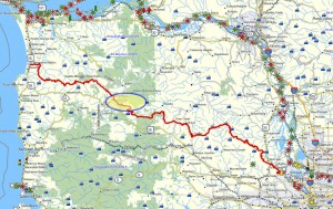
This Tillamook State Forest trail is about 39 miles from Portland. Access is directly from the Sunset Highway, with parking on the shoulder. This trail is part of the Northern Route.
Distance: 1 mile
Walk duration: 25 minutes one way; 45 minutes round trip
Travel time to trail head: 35 minutes from the Sylvan interchange on Highway 26, or 39 miles.
Elevation change: 40 feet
Trail Log:
 The Four County Point trail is located about 39 miles out of Portland. A highway sign gives ample warning that there is a hiking trail ahead, and just as the road turns and begins to ascend you will spot an additional sign alongside the road, where a wide should accommodates parking for at least a dozen cars.
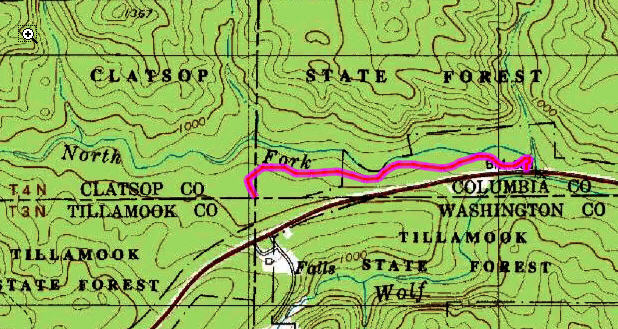
The official brochure from the Tillamook State Forest claims that this is the only place in Oregon where you can stand simultaneously in four separate counties: Tillamook, Clatsop, Columbia and Washington counties. My reaction to that is “big effing deal!” There’s so much more to this nifty 1 mile trail than contemplating some virtual dot on a map. But if that’s what it takes to get you out of your car and into the woods this trail may be the catalyst to helping you get a new life and a healthier perspective beyond the contemplation of political lines in the sand.
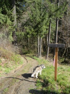
The trail itself winds through a Douglas-fir forest mixed with Vine maple, Salal, Oregon grape and Sword ferns. The North Fork of Wolf Creek runs alongside providing beautiful stream-side vistas. Follow the trail down and around before heading uphill parallel to the road. You eventually connect with an access road, but the trail diverges from this road at the top of the next hillock. The trail is relatively flat and well maintained so it can be navigated by most people  without undue burden. On the way back you can stay on the access road which leads up the slope to the road, bypassing the lower portion of the trail.
This is a nice hike to take visitors on. It will add an hour to your day-long beach excursion, but will give them a lovely impression of our deep forests – something at least as dramatic to appreciate as our lovely coastline.
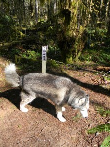
Loki letting me know what he thinks of county boundaries.

 Brief description:
I just hiked this trail after passing it on Hwy 26 for the past couple years. The newish gravel parking lot is on the north side of Hwy 26, just west of M.P. 35. There’s a short spur that takes you down to Wolf Creek, where you can walk across a log to a great, open gravel bar on the north side of the creek. Since the trail parallels the highway, it’s not super quiet, but along the creek you can forget all about the road.
Captain Shiitake:
Thanks for the update. I observed the building of the new parking lot. Yes, it’s a nice little hike suitable for visiting relatives that consider Central Park a hike. Also nice spot for a short hike to satisfy the impatient canines on the way to the beach…
This spot has been hit heavily by foot traffic lately, both human and otherwise. The area around the plaque has seen a bit of trampling, perhaps from the overly-enthusiastic feet of geocachers in hot pursuit. Just beyond the plaque, as the trail peters out, there is much evidence of elk doing their own stomping through the area. One was crashing its way through while we were there, but high-tailed it back the way he came after spying us on a nearby log.
Isn’t it ironic how humans (and apparently elk) tend to congregate around artificial landmarks, and miss the beauty that is all around them. I like the portion of the trail along the creek to be the most enjoyable.
I hiked this trail last week- beautiful! we saw the letters ‘BT’ painted in blue on a tree near the marker. does this mean anything?
No idea what BT stands for! Jim
BT stands for ‘bearing tree’ I believe. It’s a surveyor’s mark and is part of the surveys from the four counties.
Probably a Boundary Tree.
I’m adding this to my next beach day with my out of town nieces and nephews from Arkansas. Hike here, stop at Camp 18 for Cinnamon Rolls and then onto the beach for some tidepooling.
Thanks!
Oregon LNG is currently proposing to build their natural gas pipeline right through the 4 county point. There will be a 50 permanent easement where they’ll keep trees to 15 feet or less in height.