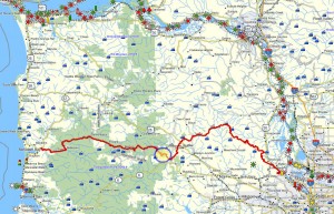
 Brief Description: This trail is the middle section of a three part “passage” connecting the trails north of US 26 to the entrance of the Salmonberry River corridor. This middle trail segment connects to the “Ridge Road to Dober Road” trail segment that serves to connect to the “Two Rocks” trail that crosses over US 26 from the north. On the southern end of this segment it connects with the trail segment that leads up the “Cochran Road” to Cochran Pond – at the top of the Salmonberry River. The “Dober Road” segment is comprised of a nice trail that crosses the northern flanks of Round Top Mountain and eventually drops down to the Cochran Road.
Duration: Expect to take about three and half hours to make the trip from the Timber Road all the way to the Cochran Road over the flank of Round Top via Dober road.
Travel time to trail head: 40 minutes from the Sylvan interchange on Highway 26. Travel 17.8 miles on The Sunset Highway to the intersection with Highway 6 (to Tillamook). Merge onto Highway 6 and follow it for 12.7 miles through Gales Creek to the intersection with the Timber Road. Turn right on to the Timber road and and travel 1.7 miles to a dirt road ascending the south side of Timber road (on your left side). This is the entrance to Dober Road that crosses a low mountain range (dominated by Round Top Mountain) and terminates at the Cochran Road.
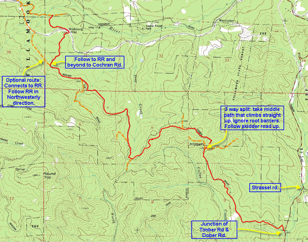
Trail Log: This segment takes us over the hills using a dirt road known as Dober road. Dober road begins on the NW Timber Road (connecting Timber with Gale’s Creek) about .7 miles southeast of where Strassel road intersected with Timber Road.
As mentioned in the previous segment, Dober road ascends into the hills on the south side of NW Timber road. Starting at an elevation of 639 feet, this dirt road climbs to up to 1283 feet in elevation. The road crests just before it reaches the 1283 elevation point and proceeds in a westerly direction along the top of a ridge. The road curves along the top of this ridge providing a nice view to the north. At the western end of the curve the road appears to split. The main track continues horizontally along the curve of the ridge heading in a northwesterly direction along the northern flank of the mountain. Another older track (much impeded by fallen trees) cuts across the ridge and curves in a southwesterly direction following along the southern flank of the mountain. Neither of these two routes will connect with the trails that climb this ridge from the west.
Instead stop at the point where these two routes split. Look directly uphill. You will see a welter of tree stumps and other wood detritus jumbled on the ridge between the two tracks. That’s the clue – someone has been busy obscuring another track that leads directly up the ridge. Scramble up the embankment and climb around the debris pile, and you will find that there is a “skidder track” extending up the crest of the ridge. This crude track climbs the ridge line up to the top of the incline. At this point this track which carries the designation as “Dober Road” has reached its zenith at an elevation of approximately 1659 feet. Here you will encounter the intersection with a road that leads down to Timber. Ignore that road and continue southwards descending along the ridge above Coffee Creek down to 1400 where the road turns west and follows Step Creek. Here the trail curves south along the flank of the Round top and climbs up to an elevation of 1675 ft. as it crosses the south fork of Step Creek. Now the road drops down to where it crosses the RR tracks and then drops down to the Cochran road at 1465 ft.

