Walk duration: 3 hours 00 minutes
Travel time to trail head: 41 minutes (34.1 miles) at Tophill
Elevation change: 1330′ in elevation above tunnel; 1254′ at top of trail from Nowakowski
Brief summary: This segment of the trail connects the Bacona Road trail that emerges at Tophill with the trail that passes over Highway 26 above the tunnel. It is mostly a series of dirt roads that serve the Cape Horn and Scofield Road areas to the west of Buxton. You can drive much of this connecting segment. The actual connecting trail is one of the least interesting parts of this extended trail, but for those wishing to make the complete trip this segment is crucial to reaching the trail systems that extend south of US 26.
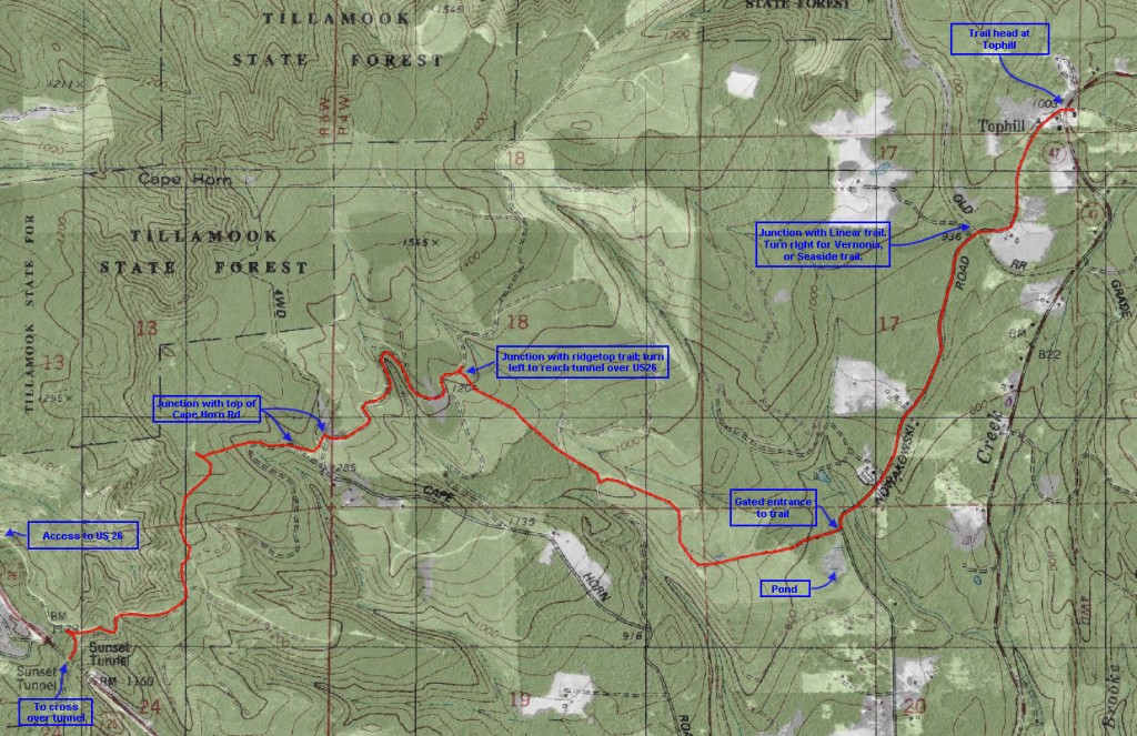
Trail Log:  Starting at Tophill at an elevation of 1046′ we follow the wide dirt road southwards between the scattered residences. Half a mile further this route will cross the Linear trail from Banks to Vernonia. To connect with the route to Seaside, turn right and follow that trail all the way to MacDonald Rd, where you can connect with the Peterson Crossover, etc. But we will continue down this country road…Just short of a mile and a half (1.42 miles) will bring you to a gate on the right side of the road with a road leading up the hillside. In case you’re unsure if this is the right road to use, just beyond this intersection is a pond on the right side. Take the right hand turn and begin to ascend the old road up the slope. At the top of this trail (2.75 miles) at an elevation of about 1254′ we will arrive at the junction with a trail that runs along the top of the ridge. I call this the Trestle View Trail.
Turn left on the Trestle View Trail and it will continue to traverse the ridge line. At the 3.65 mile point it will cut across the top of Cape Horn Road at an elevation of 1447′. From there it ascends to the top of the ridge to crest at 1547′ in elevation, before dropping down to 1330′ where the trail reaches the tunnel overpass. Just prior to that the trial meets a road coming up from the right. That road leads down to US 26 , in case you parked a vehicle there.
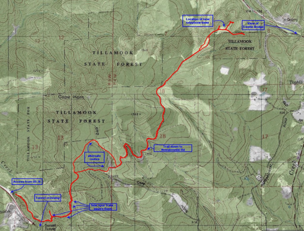
My tip: instead of walking this connecting piece consider walking the Trestle View Trail along the ridge top – all the way out to the new telephone tower – a trip of about 9.33 miles round trip. See a map below:


Thanks for having this on the web.
I’m a returning VET to the area so it will be nice after 20 plus years to go and see what has become of this wonderful place since I left. I sure hope it is still as wonderful as it was when I grew up here in the green state of Oregon.