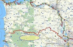
Brief summary: This well maintained horse trail is located near the railroad tracks that used to carry the Tillamook railroad through the Salmonberry wilderness to Nehalem Bay and beyond to Tillamook. This line was seriously damaged in 2007 and has little prospect of being repaired due to the extensive damage and high cost to repair the rail line.
The trail itself is only about 5 miles long, but it follows the Upper Nehalem for about 2 miles through older forests to reach Reeher Forest Campground and the associated horse camp on Cochran Road.The trail combines various kinds of scenic beauty including views of the high country ridges, the heavier stands of timber along the Nehalem River and pleasant upland meadows in between. The area is full of typical Oregon woods flowers, a wide variety of birds and lots of deer and other mammals. A thoroughly delightful mixture in a reasonable short package – highly recommended!
Distance: 2.5 miles round trip
Walk duration: 1 hours 40 minutes at a steady amble.
Travel time to trail head: 50 minutes
Driving directions to the trail head: Drive west from Portland on US 26 (Sunset Highway) for 33.6 miles (measured from the Sylvan exit at the summit of the West Hills). At the Timber intersection of US 26 (where they sell the jerky) turn left on NW Timber Road. Follow this road 3 miles to the small community of Timber. As you approach Timber the road bends left and crosses a bridge over the Nehalem. Immediately after the bridge turn right on to Cochran Road. The NW Timber Road also turns right shortly thereafter and heads up the hill. Be sure to turn on to Cochran Road before you head up the hill. Cochran road turns into a dirt road less than a mile from the intersection.
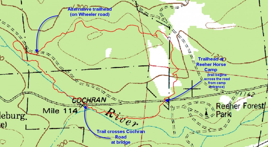
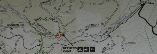 Follow Cochran Road for about 2.2 miles to Reeher Forest Camp, continue another .2 miles (to 2.4 miles from the intersection), and and you will arrive at the day use camp/horse camp. Park in this section of the camp. The trail begins right opposite the entrance to this camp.
Elevation change: This trail begins at an elevation of 1180 ft. (measured on Cochran Road). The highest point of the trail 1362 ft. is atop an ridge that climbs into the hills. After crossing the Wheeler Road, the trail descends to the Nehalem River where is drops down to 1042 ft. The total elevation change is only 320 ft spread over the entire 2.5 mile trail length – needless to say a gentle slope.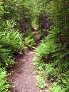
Conditions: The trail was recently built and it was constructed specifically to accommodate horses as well as foot traffic. As a result the surface is broad and flat, all the low spots prone to accumulating water have been paved with river rock, and the overhanging branches have been pruned to a height of 10 ft. or so. The trail is broad and clearly marked throughout the length.
I can imagine that the trail might be a bit muddy if you were to follow a large string of horses in wet weather. Otherwise the trail is in excellent condition and well marked.
You can walk the trail by beginning from this point and proceeding down along the side of the Nehalem River, but I recommend walking the route in a counterclockwise fashion, climbing up to the ridge line first and returning by way of the lower path along the river.
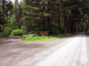
To start the hike retrace your steps back to the entrance of the camp. Directly opposite the entry to the parking lot you should see a wooden sign post marking the beginning of the trail. 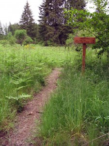 Proceed up this trail crossing an lovely meadow before you enter the woods. Shortly after entering the trees you will encounter a “T” fork in the road with one path heading off to the right and leading to Reeher’s camp.
Trail to Reeher Forest Camp splits off:
The left hand trail leads further up the hill – this is our desired route. This lovely well maintained path weaves through the trees and eventually crests the ridge above Cochran Road at an altitude of 1362 ft. Off to your right you may spot the original logging road that served the logging operation that removed the trees. You could follow this old logging road, but the trail you’re on is well maintained and traverses the 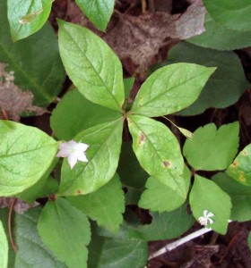 north slope of this ridge line just below the old road. Eventually it crosses the ridge-top road and begins to descend the south face; shortly thereafter you will emerge on the Wheeler Road.
This trail offered a bounty of familiar northwest plants. Pictured above is the Trientalis Latifolia, commonly known as the Star Flower based on its symmetrical six petaled flower. The Cowlitz Indians that lived in this region used an infusion of this plant’s juice as an eye wash.
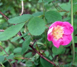 Pictured below is the Dwarf rose (Rosa gymnocarpa). This plant could be found along the higher portions of this trail. Generally it grows in forests, shrub lands from sea level to higher altitudes. Indian children loved this plant and used the colorful rose hips as beads strung into necklaces. Hunters used a wash from its branches to get rid of the human scent.
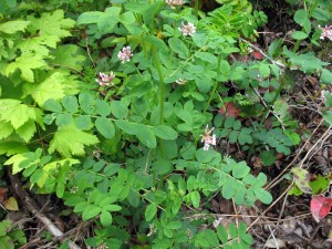 Also to be found is the American Vetch (Vicia Americana). This vine grows in the west-side woods at the edges of forests, coastal bluffs and along stream banks near the coast. Just up the coast the the Makah revered this plant as potent love medicine, “If you want your girlfriend to love you, take the plant and rub down with it after bathing, and she will love you forever.” The Quinault women would put
  this plant under their pillows to bring back their husbands. As the trail crosses the top of the ridge, you emerge briefly on to an old logging road that ran along the very crest of the ridge (the Triple C Trail paralleled it on the north side of the ridge). The road continues down the ridge to end in a clear cut area. It was here that I spotted the brilliant Western Tanager flitting across the brush piles. I took a long distance picture. And only upon close examination of the photo did I see that the bird’s mate is also sitting in the tree – just below the gaudily colored male.
Wheeler Road crossing:
The crossing is marked with sign posts and the continuation is equally well marked. From here the trail leads south-west and up the narrow valley for a bit before doubling back and heading north-east. For the next mile it follows the Nehalem River, eventually crossing Cochran Road at the Nehalem Bridge. Just beyond the bridge is the trail head for the Gale’s Creek Trail…which is currently closed since the winter storms washed out a portion of the 5.9 mile trail. But for this walk we will stay on the north side of the bridge and continue on this trail just across the road.
Nehalem Bridge:
After crossing the Cochran Road on the north side of the Nehalem bridge, follow the continuation of the trail up and along the side of the Nehalem for a half mile, weaving out of huge old logs, nurse trees and mushrooms that thrive on this shaded and moist environment. At the end of this corridor, the trail rises and emerges back at the sign we were admiring before we started on this lovely loop.

I am happy to say that the Gales Creek Trail is no longer closed, it has been re-routed a bit farther from the creek and re-opened. That connects Triple C and Step Creek trails with the trails in the Gales Creek/Story Burn and University Falls area. In fact, should they get funding, the forestry department will extend Wilson River Trial to join Story Burn which will connect all these trails together.