 If you drive to the very back of McGregor Road (off of US 26) there a small clearing just before the road splits into the Eastside Grade and the Pit Road. The McGregor Road climbs the ridge from its access point on US 26 (a quarter of a mile east of the rest area). Albeit at a distance and at a higher elevation, the Mcgregor Road parallels the gated logging road that leads to the original site of Camp McGregor – now a tree farm operated by Stimson Lumber Company.
This road eventually leads into timber tracts that were originally controlled by the Eastside Logging Company – to supply their box making factory in Portland. Hence the furthest extension of this road is also called the Eastside Grade. The alternative route, simply identified as the “Pit Road”, is also known colloguially to the foresters that maintain these routes, as the “Snagpatch road”, in honor of the many storm-toppled trees along its length.
However to get to Rock Creek, you will have to back up about 50 feet from the Y fork in the road that splits McGregor Road into the two aforementioned choices. To the left of the car will be a wide open area and in the NE corner of that clearing you should spot a rough track heading north. Follow this track past the water filled quarry and enter into the deep foliage that threatens to press in on the car. From here this rough track continues down the north face of this mountainside, switch-backing back and forth until it forks near the bottom of the slope.
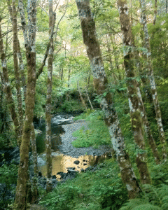
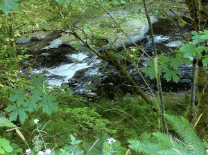
 If you proceed straight ahead you’ll eventually emerge along the lower portion of Rock Creek and will be blocked by a gate just short of the bridge over Rock Creek located east of Ginger Creek. If you turn left the road parallels Rock Creek in the upstream direction. Eventually this road also is blocked , just short of the bridge across Rock Creek. But if your car is the more of an urban vehicle with minimal clearance it would be best to park it before the big hump in the road. From there it’s just a matter of following the road over the bridge and following the stream.
  There is an uphill option soon after the bridge, but ignore that and hang left to pass through a narrow defile that marks the continuation of the original railroad grade that carried timber out of this valley. Further along the road has been obliterated by earth movement and the encroachment of a stream, but these impediments can be easily navigated on foot.
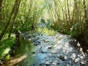
The road follows this idyllic stream all the way to US 26. It’s 3.47 miles to the next bridge and from there it’s another 5.75 miles to US 26. On foot the walk to the next bridge and back was quite enough!


How safe is it out on the back roads of the Coast Range? I usually hike where there are a lot of people like in the Gorge. I feel safe there. I know some people carry a gun for personal protection when they travel in back country. I wouldn’t want to go where I felt I needed to be that concerned about security.
I have been hiking these back roads for well over 10 years, and I have never had any overtly “dangerous” situations. The real danger in the coast range is getting lost – most of these logging roads are indistinguishable from one another to the untrained eye. I use a GPS – mainly to record where I went, but for others it might be a good idea so that they can retrace their footsteps correctly. The biggest danger is being improperly dressed and unprepared for emergencies, like getting your feet wet while trying to cross a creek.
I carry a complete emergency kit that includes warm socks, bandages, a candle, matches, a space blanket, a bivvy sack, medical supplies, a knife, a map of the region, concentrated foods, etc. Normally, I don’t touch the stuff in this hip pouch, but I always carry it. In the coldest months of the year I carry a larger version with a small tent and cooker, in case I break a leg or something and have to hunker down in the snow. Hypothermia is the biggest threat to humans in the coast range. And the most dangerous moments for the hiker is when they’ve hiked miles and think they’re close to when they started. The temptation then is to bushwhack straight through the woods to where you think the start of the trail is located. It’s the thought of the many miles that you would have to retrace to get back to the beginning that makes one make dangerous choices. I call it the “sunk cost” trap and it’s been the instigation of many bad decisions. I am a pretty good bushwhacker and have an excellent sense of direction in the wilds, but most people don’t especially in Oregon’s thick vegetation. Many people also make the mistake of trying to follow the water courses – that’s the absolute worst choice since those areas are wet, cold and congested with Devil’s Club and made impenetrable by vine-maple.
Since I alsmost always walk alone, I also carry a homing beacon (at the behest of my wife) to issue an SOS, since most of these areas do not have cell phone coverage. As for animals. The Elk will leave you alone, if you do the same for them. The bears are much more scared of you than visa-versa, and I frankly hardly ever see them – only near the coast in the late summer when the Salmonberries are out. Then note the berry patch locations and “announce” you presence when entering these areas so as not to surprise a bear. But bears are usually very frightened of humans and will scramble away as soon as they see you. Mountain lions do exist in these areas, but it is EXTREMELY rare to even catch sight of one, and there have never been an attacks on humans in Oregon – ever.
The biggest danger is getting lost, cold and wet. And making poor decisions without adequate clothing or emergency gear. That will kill more hikers than anything else.
Jim
Oh, and I never carry a gun. There are no animals in our woods aggressive enough to warrant carrying a gun – except other humans. If we had feral pigs in the coast range, I might consider carrying a sidearm, but otherwise I consider it “overkill” and will depend upon my common sense to get me out of any unexpected encounters with animals or other humans.
BTW, I have hunted and hiked all around the world from Kenya to Bosnia, and from Austria to Malaysia – so I do have experience with dangerous game and in those cases I did often carry a gun. But I don’t feel it’s necessary here. Jim
You wrote, “The bears are much more scared of you than visa-versa, and I frankly hardly ever see them – only near the coast in the late summer when the Salmonberries are out.”
There are several excellent food sources the bears regularly partake of. They really love the salal, and eat the blossoms and the berries from spring to late summer. Even blackberries are an important food source from summer to early fall in some areas. However, salmonberries are strictly an early season berry and are not available in abundance much past the beginning of summer.