The hazards of Northwest Forests

In the middle of winter my explorations seem to slow down partly because of the cold drenching rains, partly due to the family festivities, and further slowed by the seasonal sniffles and colds that make one loath to forsake the comforts of home. But come January and I get that restlessness that eventually causes my wife to send me out into the woods, knowing full well that my demeanor and general grumpiness won’t be dissipated by anything less  than letting me slip my leash and disappear into the fog and low hanging clouds that shroud the coastal mountains at this time of year.

This year the catalyst came after a morning spent interviewing Craig Olsen and Tom Budge , the current and former managers of Longview Fiber’s Vernonia unit. I had asked to meet with them to get a perspective of how they perceive the land through which I have been traipsing for these last few years. After wearing down a half dozen pairs of hiking boots exploring all the remote nooks and crannies of the Longview Fiber logging road network, I was particularly interested in knowing more about how these dusty filaments of industry had been laid and maintained along the ever shifting Coast range  slopes.

Tom Budge recounted how he was the first Longview Fibre employee to move to the Vernonia unit in 1962. The biggest challenge they had faced in those days had been harvesting the huge dead-fall that resulted from that year’s Columbus Day Storm. In those days there were few roads through the area. Mostly they had access via the railroad grades that had been vacated of tracks and some CCC roads. The latter were designed for fire protection and not wood extraction.
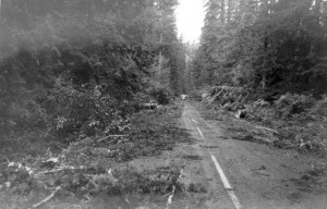
Building roads in Columbia County was a bit easier than in Clatsop or Tillamook counties, because the terrain was not as treacherous. Longview Fibre was able to build about 20 miles of road a year. In the denser and steeper terrain near the coast they were only able to construct about 7 miles of roads per year. While this may not seem like a huge accomplishment, until you consider the plight of Lieutenant George H. Derby who was charged with surveying an overland route from Astoria to Salem in 1865. In his report on the proposed Military Road, Lieutenant Derby wrote thatin order to, “get through (the underbrush) with our pack animals, laboring incessantly from daylight until almost dark, with six active axemen, (they were) seldom making more than 5 miles a day” to simply cut an initial footpath through the wild terrain.

With the building of the roads came increased access to the forests and eventually it became necessary to install gates to combat the increasing timber theft, vandalism and trash deposits. This new exclusion caused anacrimonious rift with the local communities who had been hunting these lands for generations and felt it was their “God Given” right to access the forests.

Asked about whether an entry fee similar to the one imposed by International Paper in Southern Oregon might eventually be imposed on Longview Fibre properties in northern Oregon, both Tom and Craig grimaced remembering the fight they had when the “blue gates” were erected. No, they needed the goodwill of the communities they operated in and they didn’t feel that it would be possible to impose entry fees in Northern Oregon where hunting by the locals (on private timber lands) was an essential means of keeping their larders stocked over the winter.
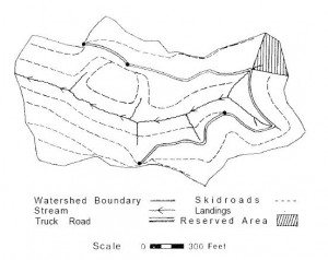
When I asked how these roads were built Tom rummaged through an old bookshelf and extracted a copy of a 1997 typewritten “Treatise on Logging Road Layout and Related Subjects” by “Bull” Durham. As I was to discover the related subjects were the real gems in this “treatise”. The treatise starts with the following practical advice, “After the office interview (with the land owner) have the client take you to the property and show you what he knows: roads, line crossings, line tags, mean dogs, crazy hermits, hostile widows.

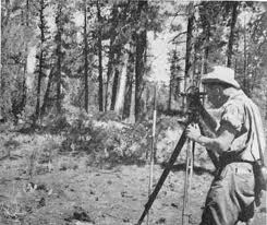
Yes, I did finally learn that the “gradeline” roads were so designated because of the way they were surveyed – using an elevated line at the height of your eye and marked along the tree-line.  These gradeline roads usually connected to the “mainlines” which were the main arterial routes providing access to vast tracts of timber. Road grades for logging roads, Bull advised, should be limited to 15% (a rise of 15 feet over a total distance of 100 feet).
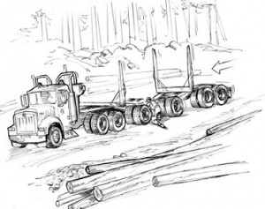
At grades higher than 15% it becomes difficult to “ballast” or maintain a rocked surface…18% was considered the absolute maximum.In sharp curves the forest often had to be cut back to keep the long logs jutting off the end of the load from gouging the embankments on the outside of the curve. Cars travelling in the opposite direction who had the misfortune to meet a log truck in such a corner had, on occasion, been swept off the road and tumbled down the mountainside. The cautionary tales about driving on active logging roads are not entirely frivolous…
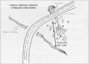
But the life of a road builder was not just about trigonometry tables,  steel tapes and staff compasses. Bull Durham makes sure to warn us about the many sources of danger in the woods, including the usual litany of hazards  from bear to buck deer in mating season (“they go a little goofy”) and even mushroom hunters! He also warns against hunters (homo stupidus) suggesting that they “may shoot at anything; they go a little nuts during the hunting season. Don’t wear bright colors to give them a target.

But his final warning about salamanders was truly bizarre, “Several years ago in Coos County the rigging crew on a yarding job were setting the chokers down in a draw where they turned up a giant salamander…some of the boys dared another one to bite the head off the salamander…the boy took the dare; bit the head off and went into convulsions and died before anything could be done for him.

Posted in Logging history | Leave a comment

In the twilight of a late summer’s day.

September 25, the day before my birthday promised to be a lovely Indian summer day, and all the myriad domestic duties just couldn’t keep me out of the woods! It was late in the morning when I finally got off on highway 26 and headed into the Coast range. Turning south on the Salmonberry Road, I had soon crested Coyote Corner passing groups of hunters target shooting in preparation for the opening of hunting season. Further in, past Camp Nine, I would pass the discreetly parked cars of the bow hunters along the lip of the Salmonberry Canyon. But I was going further down – all the way to the bottom of the North Fork of the Salmonberry – or at least as far down as I could in my Odyssey.

Surprisingly the North Fork Salmonberry Road is much gentler in grade and smoother than the infamous Beaver Slide Road. About 2.75 miles beyond “Camp Nine”, I parked the car in a small meadow just as the road turned northwards into a series of switchbacks that descended 1.5 miles and 725 feet in elevation down into the North Fork of the Salmonberry.

At the bottom, I followed the old track (the road has long since been washed out) that remains thanks to the elk that travel 1.4 mile along the North Fork of the Salmonberry down to reach the confluence with the main stem of the Salmonberry. In parts it’s a “linear scramble” where fallen trees, landslides and eroded banks have obliterated the original road grade.

At the end of this trail sits a beautiful little clearing situated at the apex of the two valley and overlooking the Salmonberry about 50 feet below. A trail leads around the crest of the promontory down to the rocky beach marking the confluence of the North Fork of the Salmonberry with the main stem of the river.

Across the river a rough track leads up the embankment and connects with a side rail spur that goes around Tunnel 29. You can follow the rail spur in either direction to rejoin the main track. The distance to the Beaver Slide Roads is about 2 miles, or about an hour’s walk. Heading west it’s a 12.4 mile trudge to the intersection with the Nehalem River and the next road.

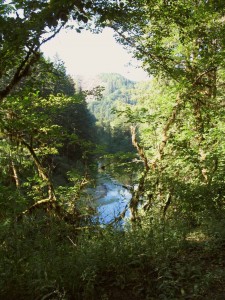
The sense of isolation is pretty palpable as you enter the Salmonberry River. Perhaps its the steep hillsides that block the sun, the long climb to any  navigable road, or the evidence of recent malevolent power visible everywhere you look along this savage river canyon.

I grow fearful as I stare upon mansion-sized log jams, see huge boulders tossed carelessly into the forests, and gaze upon old growth tree trunks torn from their foundations and crushed beneath the pressure of the surging water. I can imagine the roar of the river’s rage as the winds whips through the churning spew of molten mud, heaving boulders and cartwheeling trees.  In the midst of this wild chaos, the mountains released their own tumultuous contributions as the surging streams and collapsing hillsides poured their earth, rocks and trees upon the roiling torrent.  Just imagining the utter brutality of nature’s rage makes me feel insignificant and  helplessness as I tiptoe up this ravaged canyon expecting at any moment that some huge force will wrench the world around and crush me like some inconsequential ant.

Each detour between the river’s gargantuan boulders, each slippery traverse across clinging elk trails, each dark and muddy tunnel distorts the time and distance covered and unravels my reasons for being here, at all. I struggle on through the foreboding isolation, picking my way through the twisted iron carnage, feeling the minutes unraveling like a rope from which I dangle.  Each bend in the river is a tedious obstacle course I  have to retrace, each detour into the tangled undergrowth another scramble added to my retreat, and each minute spent walking deeper into the encroaching shade will guarantee more gloom for my long ascent. I feel a surging tide of isolation as I survey a final  broken bank of fallen rocks and earth entangled in a twisted skein of iron rails. From the gloom seeping down the forested canyon walls I sense a vague danger, some forest consciousness warning me that my trespass is becoming intolerable… and I  turn back to follow the receding sun, and to climb up the canyon walls even as the suns slips quietly up ahead of me. Even as I regain the heights and the shadows fall in step with me, I know the forest has relinquished its malevolence and is once again enfolding me in the dark golden afterglow that baths the forest floor on one of the last days of summer.

Posted in Salmonberry Trails | Leave a comment

Roger’s Peak – hiking one of the North Coasts tallest peaks.

You know, I’ve got to stop doing this! I’m supposed to be completing my guide for the two overland routes from Portland to the Coast and focusing on filling in the detail on all the walks north and south of US 26, but then I get this urge to scout out another remote and dramatic feature of the Coast range – like Roger’s Peak – the highest peak in the north Coast range Mountains at 3706 ft.

Consider that Sandy, Oregon is situated at about 1,000 feet in elevation and Government Camp at about 4,000 feet in elevation. To ascend the 3,000 feet US 26 takes 30 miles to make the ascent. From the Salmonberry River (880 feet) to the top of Roger’s Peak (3706 ft) it’s only 3.5 miles as the crow flies – that almost 10 times steeper than the slope of the Cascades!

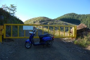
Someone actually made it up here on a scooter? Amazing!

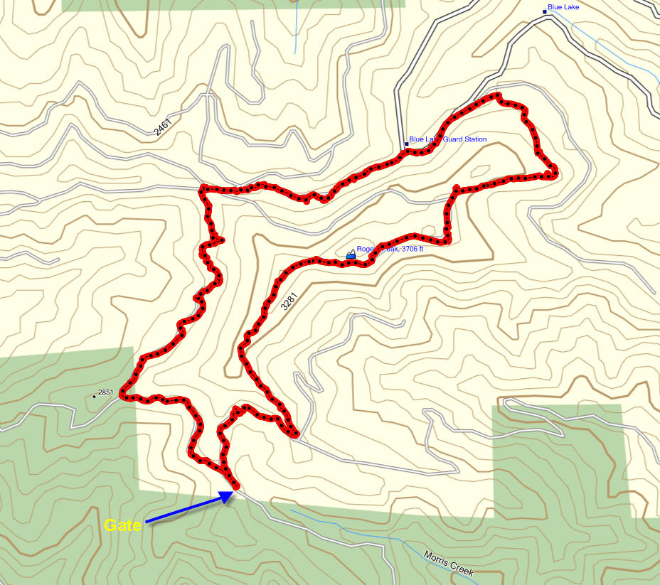
So there I was last Sunday, parked flush up against the gate that barred access to the private logging land around Roger’s Peak.  Just a word of advice the road is pretty narrow up near the gate, so turning around is a bit problematic. You can either turn first and back up the the gate or back down again until you can turn.

To get to this gate drive just beyond Lee’s Camp on Highway 6 and turn right. Follow the North Fork of the Wilson River past Diamond Mill Park. Eventually you will come to a bridge that goes straight up the North Fork of the Wilson River – turn left and follow this fork of the Wilson river in a westerly direction. presently, you will encounter a bridge on your right that crossed this Fork of the Wilson and climb up into the Morris Creek watershed. Follow this steep tertiary road (dotted line) that leads up to the head of the Morris Creek canyon.

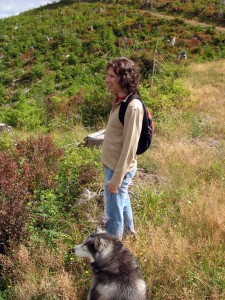
Max and I walked up over the ridge line and looked down into the Ripple Creek watershed. We proceeded onwards walking around Roger’s Peak to find the beginning of the Belding Road –  that infamous 3,000 ft. descent down to the Salmonberry River. But given the time required to get to the top of the Belding Road it was not feasible to descend the 6.6 mile to the river. So instead Max and I decided to climb Roger’s Peak – a 14 mile circuit.

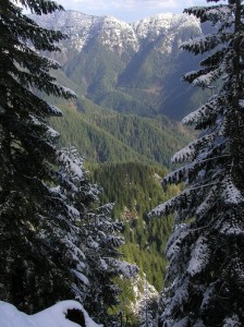
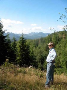
It was remote, rugged and beautiful with view across the North Coast range that couldn’t be beat! Here’s a beautiful shot from the internet taken in the winter snows.

What I was really reconnoitering was the southern access road to the Salmonberry River.  At the base of Beaver Slide Road there used to be a bridge that crossed the river and ascended the southern shore, climbing all the way to the Standard Grade road that runs alongside Roger’s peak. I wanted to locate that road so that I might eventually walk down it to the Salmonberry River.  The maps show the Belding Road descending from near the top of Roger’ 3706 foot peak down to the river at about 880 feet – a drop of almost 3,000 feet in less than 2 miles horizontally.  Sure I might be able to get down to the river, but getting back…?

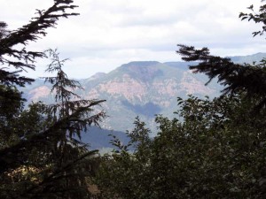
Two and a quarter miles from the gate we did finally encounter the 5 -way intersection that marks the beginning of the Belding Road. But by then we had decided to walk the circuit of the peak climbing over the top on the return leg. This route took us to the Northeastern corner of the mountain where we could look out and see King’s Mountain and Saddle Mountain to the north. To the northwest was the deep Salmonberry valley with massive escarpments shining pink in the late afternoon sun.

At the north end of the mountain, we took the circuit route and then another steeper option that takes you up the shoulder of the face on to the top of the mountain. The grade gets progressively steeper and the rock underfoot chunkier, but eventually four and a half miles into the hike we arrive at the first north-facing promontories that appears to represent a “high point”. From here we gained a spectacular view of the North Coast range all the way to Saddle Mountain. Spread out before us were the watersheds for Ripple Creek and Bathtub Creek – both of which we crossed on our way down the Salmonberry a couple of week before.

The track we were on exhibited much elk and deer traffic, but no evidence of bears – although the berry bushes had certainly been stripped base.

From the first vantage point at 3415 ft, we continued to climb another half mile eventually reaching a narrow ridge that separates the southern flank from the northern flank at an altitude of 3568 ft. Moving along the top of this mountain the road dips a bit (3517 ft.), but quickly ascends again to to about 3553 – before finally slopping down a southwards facing ridge. On the south side the slope is very steep and falls away to Morris Creek about 1000 feet below.

The descent continues over an overgrown route eventually intersecting with a well maintained road that traverses the southern slope. We turn right on this road and follow it back out to the gate. In all the circuit was 7.15 miles in length and took about 3 1/2 hours to complete.

Final thoughts: great views, rugged terrain, exposed to coastal weather – well worth the effort.

Posted in Salmonberry Trails | Leave a comment

The Senator Gordon Smith tunnel for deer!

Typically I try to use the outdoors to transcend the inanities of urban life, and usually 30 miles of rough terrain is enough to shield me from reminders of how ironic our existence can be. But this morning, the ridiculous efforts of mankind intruded into my private reverie more than once.

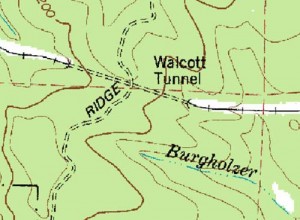
This morning I set out to explore whether there was a viable route from the trail that crosses over the top of US 26 down to the defunct railroad that runs from Buxton to Tillamook. The route that I used to travel south from US 26 crosses over this railroad line as it passes through the Walcott tunnel under Ridge Road – a minor dirt road accessible from Strassel road. My idea was that the southern walking route to the coast would be much improved if I could use the Tillamook Railroad route to get all the way to Cochran – thus avoiding the intervening mountain. It was worth a through bushwhacking extravaganza, I thought.

Loki and I hiked down the slope towards the abandoned railroad line using an old logging road and a subsequent skidder track that eventually petered out about 2/3 of the way down the slope. In vain we tried to reach the railroad track but the brush strewn slope was simply too thick and steep to navigate – especially for Loki whose legs cannot penetrate the piled branches underfoot. Eventually we had to back track a half mile and then follow an elk trail across Castor Creek and up a steep slope on the other side to reach the old railroad line.

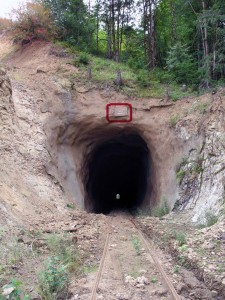
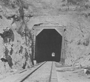
"Senator Gordon Smith Tunnel" to nowhere?

This line originally completed in 1911 by the Pacific Railway & Navigation Company line hasn’t been used since the storms of 2007 wiped out a number of trestles and bridges as it passes through the coast range. Today no commercial traffic runs along this line, and even hikers are scarce on this portion of the line. Judging from the tracks, only the elk and deer vie for the use of this portal. Mine were the only human tracks to be seen.

So imagine my surprise when I see a sign hanging from a stump above the tunnel proudly proclaiming this the Senator Gordon Smith Tunnel.

Talk about a tunnel to nowhere!

I can only imagine what sums were spent to refurbish this tunnel, with concrete blasted all along the interior of this 1/4 mile tunnel. And today no one uses this tunnel except the animals that traverse this muddy subterranean route from the Tualatin watershed to the Nehalem watershed.

Of course, there was no way that the venerable Senator could have known that nature would undercut his colossal  monument. The sad futility still clearly evident on that battered wooden sign put me in mind to recall Percy Bysshe Shelley’s poem, Ozymandias. “Oh yes, look on my Senatorial achievements and despair, ye mighty!”

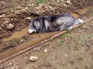
Loki’s response to the awe inspiring signage was perhaps less skeptical as he promptly prostrated himself in the closest mud puddle and began lapping up the brown liquid with gusto! No doubt he was fortifying himself for the prospect of the lone and level sands that stretched far away on the far side of the tunnel…

But on the far side of this tunnel, we encountered quite a different demonstration of that human striving to leave an image of our passing. As Loki and I sought to find a viable route back, we wandered northwards  looking for routes through the thick and steep vegetation. This was hardly the promised “lone and level sands”, but it was no less formidable!

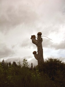
Rocks perched on a lifeless leg of wood...

Eventually, I navigated the twisting elk trails up to a remote skidder track that soon evolved into a rudimentary logging road. All around stood thickets of brash alders trying to compete with the adolescent fir trees that would soon tower overhead. But standing out amongst this welter of new growth was a lifeless leg of wood that had been left as a mute testimonial to that universal urge to leave our mark. An urge not limited to the powerful, but even afflicting the whimsical log loader who left his autograph in the form of large rocks perched on a pedestal of wizened wood. This time, I found myself smiling alongside the anonymous sculptor.

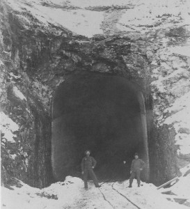
Historical note: Tunnel # 1,  eight and one-half miles out of Buxton is the longest tunnel of the 13 built along the Pacific Railway & Navigation Company Line (11 alone were built along the Salmonberry) at 1,435 feet in length. It took eight months to excavate the 24,150 cubic yards of rock and earth that were hauled away by hand truck from this tunnel – that’s the equivalent of 2,415 ten yard dump trucks! The refurbishment of that tunnel was a mere picnic by comparison.

Posted in Logging history, Railroads | 2 Comments

Skinnydipping in the Salmonberry

Yesterday I reconnoitered the western end of the Salmonberry River railroad corridor, which can be accessed by road from Elsie. For 12 miles this scenic back road (with vicious potholes at the southern end) follows the Nehalem River down to its juncture with the Salmonberry. The bridge that used to stand here and allowed passage through to Nehalem Bay was destroyed in the 2007 storms, which also destroyed the railroad that goes up the Salmonberry River.

The Salmonberry is one of Oregon’s most beautiful wild rivers, in my estimation ranking up there with the Grand Ronde River in NE Oregon and the Rogue in Southern Oregon. But the Salmonberry has two other attractive features – it’s close to Portland, and it’s infrequently traversed on foot or by water. With the exception of fly-fishermen who prize this stretch of water, or the occasional hiker hardly anyone goes up or down the Salmonberry.

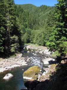
And above all the Salmonberry is gorgeous! This untrammeled mountain river spills its way from Cochran Pond near the the summit of the Coast Range for 18 miles all the way into the Nehalem. If there were one place in Oregon to build a cabin and live off the land, this would be it. few rivers can match the Salmonberry for its sheer beauty and wild environs. This stream shows off all of what’s fantastic about the coast range: its rugged almost rain forest terrain, the emerald pools interspersed by white water rapids, the enormous boulders strewn along the banks, the moss covered cliffs that overhang the twisted course of the stream, and the best steal head fishing in the state. What more could you ask?

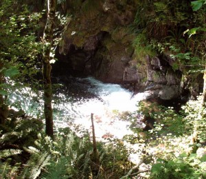
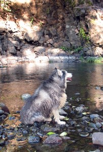
Well, for Loki and myself it was a long soak in the Buick Canyon pool pictured above. About 1.4 miles above the juncture with the Nehalem just far enough to have left behind the campers congregated along the Nehalem River… or so I thought.  After lounging about in the crystal clear water and sunning ourselves dry on the sandy bank we wandered upstream around the bend. There I was drawn to some level land on the far side that suggested it might have been used by campers. Wondering if there was possibly another route into this point on the river, I explored a bit further and soon discovered a rudimentary dwelling half hidden in the trees on the far side of the river. Further reconnoitering revealed a steel cable for crossing the river, and a cooler dangling into the river. Using my binoculars I soon spied a rifle leaning ominously on the front door. There was no sign of any rocking chair, coon dogs or a banjo, but it was a reminder that such remote locations can draw people who prize their privacy above all else. Under the circumstances I thought it best to respect that isolationism.

But there is room along the 18 miles of this beautiful river to accommodate all of us intrepid enough to venture off the grid for what ever time we have to spare. And on this day, I could only regret that I did not have more time to spare.

Posted in Salmonberry Trails | Leave a comment

The path least taken

Welcome to Forest Hiker! This site is a paean to the beauty of Oregon’s coastal mountains and the unintended consequence of my frequent rambles along the miles of undocumented forest roads, overgrown “skidder tracks” and single file elk tracks that thread their ways through this inspiring landscape.

This site is a vehicle for my observations, my research on flora, fauna and natural history, my maps and my trail recommendations – along with an ample dose of considering the workings of the greater natural community in whose company we find ourselves as we wander down the leafy corridors though Oregon’s coastal forests.

Aldo Leopold, the famed conservationist once counseled his students against conformity in how they spent their leisure, ” It is because the vast majority of people do not have the courage to venture off the beaten path that they fail to find adventure, and live lop-sided lives…A good healthy curiosity is better equipment to venture forth than any amount of learning or education…the beaten paths of conformity are literally a prison.”

Like Aldo, I confess that I too take great pleasure going “in search of adventure without regard to prudence, self-improvement, learning or any other serious thing.”

Posted in Uncategorized | Leave a comment