Mud is us!

Mud is us!

If you spend much time squelching through Oregon’s soggy landscapes you might get the feeling that we have only recently squeezed from the primordial mud. And that might not be too far off, if you permit me to readjust your watch to count eons instead of minutes.

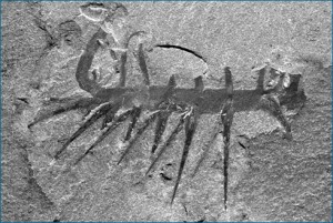
Less than a complete eon ago, just a mere 400 million years ago, during the Oligocene period Idaho had a lock on the best tropical beachfront property in the Northwest, but demand was a bit sluggish since only a few ungainly amphibians had actually waddled ashore to discover the benefits of terra firma. Instead the real action was in Oregon, which was covered by a subtropical sea and dotted with corral reefs. These warm waters were teaming with whimsical life forms. Jellyfish floated aimlessly in the waters, worms squirmed through the silted seabed, centipedes marched stoically across the muddy ocean floors and trilobites sporting fancy ribbed carapaces dominated the social scene for more than 350 million years. But as our emerging continent migrated slowly northwards cooling water temperatures would soon introduce new species like starfish, cuttlefish, bi-valve clams, horseshoe crabs, sharks and primitive vegetation on land.

In the meantime, the mud that I mentioned earlier was continuing to flow unabated into the shallow sea covering the eon’s worth of discarded trilobite carapaces, the remains of the myriad centipedes and the near infinite squiggly-wigglies that perished in that tepid bath that covered our present-day Oregon. Baked into the primordial muck for eternity these caked layers sank quietly into the earth’s crust. But here and there the stresses and jostling of the earth’s skin would force one of these long-buried layers to the surface to reveal a crowded catacomb of early protean life.

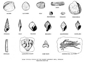
For those with the feet to discover these troves and the eyes to discern them, many of the North Coast mountains’ moss-covered outcroppings serve as remarkable windows into an antiquity beyond comprehension to most of us. The vicinities of the Sunset Highway are rich in paleontological evidence of this long-ago era in which mud itself was both the stimulus for life and the coffin to which it was confined once the shallow seas in Oregon dried to become the basis for our current muddy existence.
That said, my best find was not a crumbling mollusk, but rather an old report issued by the Oregon Department of Geology and Mineral Industries (DOGAMI) in 1957 and written by Margaret L. Steere. With that pragmatic certainty that characterized so our post-war years, Margaret begins her report with the incontrovertible assertion that “the Sunset Highway area…is famous for its abundant marine fossils of the Oligocene Age.” Why, of course, silly me for not immediately knowing that!

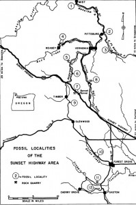
The oldest fossiliferous sediments found in Oregon,  the Cowlitz formation, date back to the Upper Eocene, but in this region they are comprised mostly of conglomerates and sandstone that were deposited near the shores of the Eocene sea that covered our area. Settled on top of this layer, are the more interesting Oligocene marine formations. The first two sites to be recorded were located near the tiny community of Keasey (near Vernonia) and about .2 miles north of the small community of Pittsburg on US 47. This formation appears as a grey siltstone formation that reaches 2,000 ft. in depth and runs generally in a broad band from Keasey in the north to Cherry Grove (near Gaston) in the south.

The most accessible locations mentioned in the report include the following sites that are in close proximity to existing hikes that I have surveyed.

Site #2 is located .2 miles north of the community of Pittsburg on Highway 47. The Vernonia to Elk Creek trail cuts across the headland between the east Fork of the Nehalem River and the main stem of the Nehalem River as it turns northwards from Vernonia. On the DOGAMI map, it cuts horizontally from Site # 3 to Vernonia itself. Though not in walking vicinity of the Vernonia to Elk Creek trail, the Pittsburg site is mere minutes away by car.
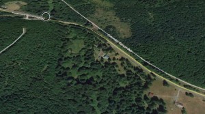
Site #3 is a short distance on foot from the Crown Zellerbach trail that parallels the county road between Scappoose and Vernonia. This stretch of the trail is surveyed and described as the “Elk Creek to Summit” segment of the CZ Trail.

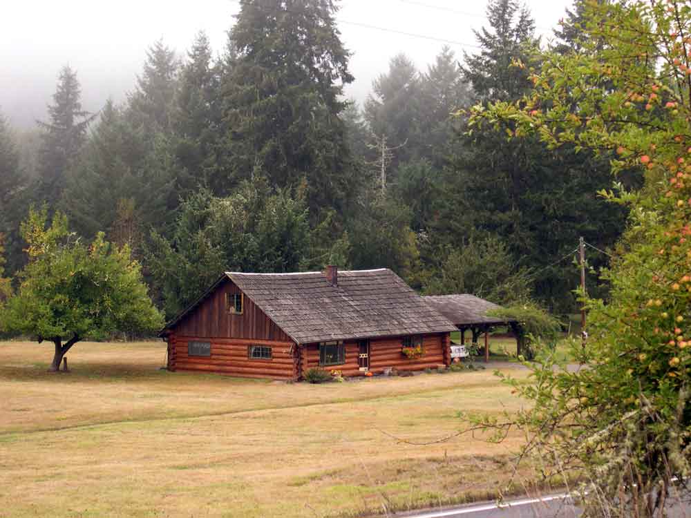
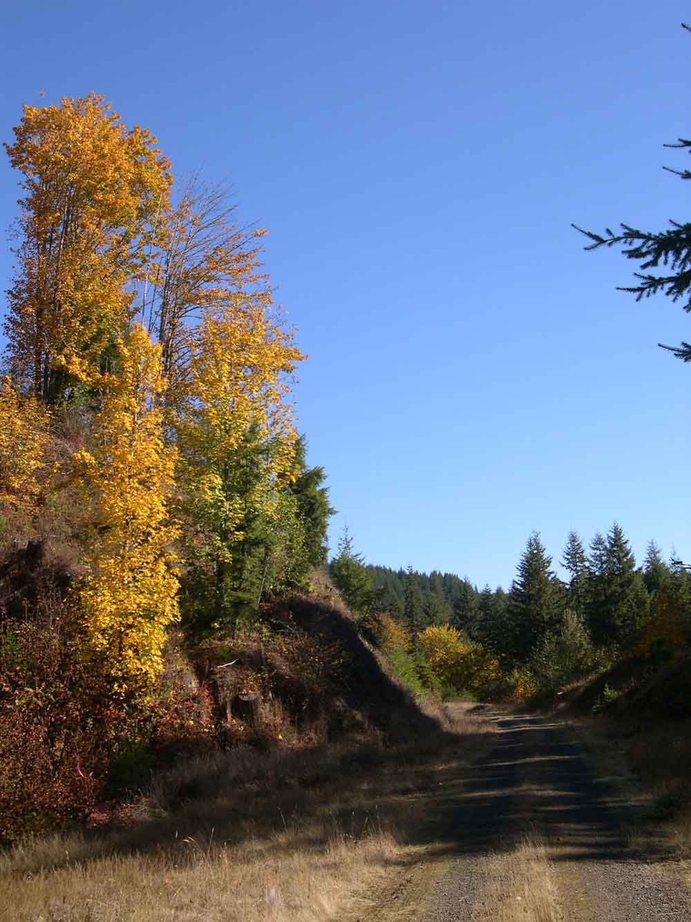
Just to the west of Hawkins Creek, the CZ trail runs parallel with the county road. It passes by a pretty log cabin set in a meadow on the south side of the county road. All along this gently descending slope look for outcroppings on the north side of the trail.  This portion of the trail had several trestles as recently as the 1970’s, but they were removed after the development of the County Park at Scaponia. The 1957 DOGAMI report indicates that the fossil beds are exposed for several hundred feet all along this portion of the trail. A short distance past the log cabin the county road and the CZ trail diverge, but before they split there is a gate that connects the two roads. From here it is a short walk along the county road to cross the bridge.  At the west end of the bridge you will find another outcropping on a steep slope about 30 feet above the road.
Site # 4

This site is located near the erstwhile community of Keasey – which now is comprised of one house and a herd of elk. Keasey can be reached by traveling 8 miles from State Avenue and Highway 47 in Vernonia. The outcroppings occur on the banks of Rock Creek. According to the 1957 directions the best sites are located near the trestle that crossed Rock Creek to the Southwest of Keasey, sometimes referred to as Dead Man’s Trestle. The outcroppings occur near the water level on the low bank of Rock Creek, about 8.8 miles from Vernonia.

While this location is not mentioned in any of the trails surveyed, it is along the route that I frequently took to reach the East-side Grade and Rocky Point. If one goes to the gate at the end of the road beyond Keasey, a logging road ascends the east slope of the Rock Creek ravine. This route will eventually bring you to the Rocky Point quarry at the summit (DOGAMI site #5), from whence you can connect with the East-side Grade.

The rail line originally followed Rock Creek all the way to Camp McGregor near the Sunset Highway. However today it is difficult to follow the old rail line since much of this portion of the route was traversed by trestle, and once removed there remained no passable grade to follow. I have descended Rock Creek from above, but even on the west side of the Creek the track is quite obliterated and the terrain is too steep to traverse without significant struggles.

Site # 5
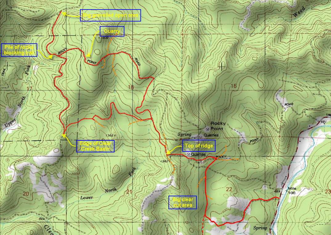
This location is a quarry located on Rocky Point to the west of the Timber Road leading north from the Sunset Highway to Vernonia. From the attached map of the Rocky Point to East Side Grade Trail, you can see that this area has a number of quarries and the description is unclear as to which of these it is. The area can be reached from the Timber road, as described in the “Rocky Point to East Side Grade” trail description.
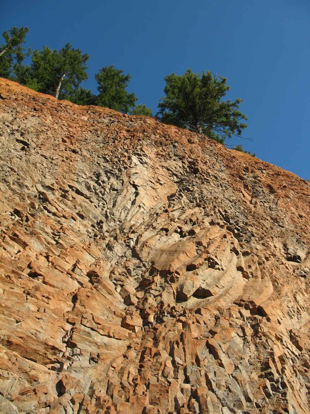
Near the juncture with the East Side Grade is a quarry (marked on the map, as “quarry”) that features a spectacular basalt formation that shows the beauty of the folding that can sometime rearrange the basalt strata into amazing designs.

Site # 6

Another fossiliferous outcropping of the Keasey formation occurs in a prominent cut along the Nehalem River on the east side of the road from Timber to Vernonia, 3 miles north of the junction with the Sunset Highway. Large pelecypods were reportedly found at this site.

Site # 7
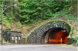
Both ends of the Dennis L. Edwards tunnel were originally cited as being good locations to reach the underlying shale beds that contained the fossil-bearing outcroppings, but since it’s the tunnel’s construction in 1940 weathering and grass plantings have degraded the soft shale causing it to disintegrate. In 2002 the tunnel was repaired, and the cuts into the hillside have been further landscaped obscuring the underlying fossil beds.

Site # 8
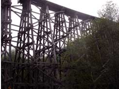
Another location mentioned in the 1957 report is at either end of the high curving rail road trestle that crosses Highway 47 about 6.2 miles north of the Sunset highway. This location is located very close to the Banks to Vernonia trail, which is described in the “Stub Stewart to Trestle” segment of the Banks to Vernonia Trail. According to the DOGAMI report the site is noted for the presence of fossilized crinoids. To reach the outcroppings follow the Banks to Vernonia Trail from the nearby parking lot up the tracks and follow them out to the trestle. Along the way you can locate the fossils in the exposed outcroppings along the tracks.

Site # 9

Further south there are further instances where the Keasey formation is exposed. On the road that connects Timber to the Gales Creek area is an excellent exposed fossil bed. This Keasey formation crops up in a prominent cut at a sharp bend in the Timber-Glenwood road. It is located 1.3 miles south of the railroad crossing in Timber or about 5.2 miles from Glenwood.

Site # 10, 11 and 12

Three further sites are mentioned in Gales Creek area, at a quarry on Scoggins Creek road and finally on the north side of Cherry Grove road. This is also the area of known Indian Petroglyphs along the embankments of the upper Tualatin River, near the Richmond Hill Bridge.

Posted in Geology | 1 Comment

Contagion – could it happen here? It did!

The recent movie “Contagion” depicts a world beset by a terrifying disease that threatens to unravel the world as we know it. The New Yorker review sums it up, “As panic engulfs the country, civil society dissolves. Crowds assault banks and stores; people desperate for a cure attack pharmacies. The episodes are violent and appalling but mercifully brief.”

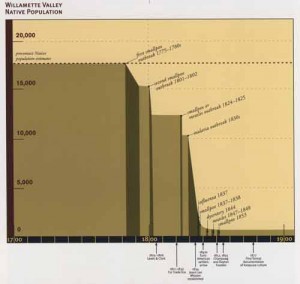
But thank goodness this is Hollywood, and none of this happened, right? Many movie-goers were skeptical of whether a disease could have such a widespread  impact as the 30% mortality rate cited in the movie. Yet right here in the Pacific Northwest we experienced an epidemic that reached mortality rates approaching 90% of the population.

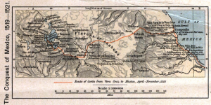
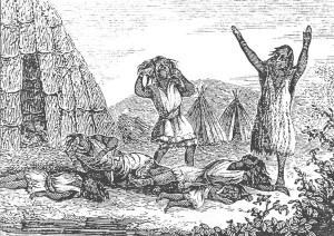
When did this happen, and why are we not aware of it? Well, historians have only recently in the last few decades been able to document the dramatic die-off that occurred long before most Europeans arrived in the interior of this continent. In fact the epidemic that swept through the Americas started almost the moment that the European stepped off their boats in Hispaniola. The first outbreak of smallpox in the Americas was recorded in Hispaniola in 1518. It killed a third of the native population before jumping to the other islands. In 1520 Cortez attacked the Aztecs and his Lieutenant Panfilo de Narvaez landed near the contemporary city of Vera Cruz. Among his troops was an African slave named Francisco Eguia, who had small pox. The disease quickly spread to the native population and swept through the Aztecs capital, Tenochtitlan. From there it moved south all the way to the Inca empire where it ravaged the population in 1533, 1535, 1558 and 1565. One of the witnesses recalled that, ” they died by the scores and hundreds. Villages were depopulated. Corpses were scattered over the fields or piled in the houses or huts.”  And afterwards they were further reduced by successive waves of influenza, typhus, diptheria and measles. The scholar Henry Dobyens estmates that it killed 9 out of ten of the Incas.

The first documented pandemic swept north from Guatemala in the late 1770’s. By 1780 it had reached the Navaho pueblos in New Mexico. From there it moved on to the  Comanches who traded with their linguistic cousins the Shoshones and Crows. The Shoshones’ traditional territory bridged the Rockies where they traded both with the Blackfeet on the Plains and with the Kootenai and Piegan Indians on the western slopes of the Rockies. And from there it swept down the Columbia to arrive at the Chinook villages in 1775.

What’s significant about this new information is that the major destruction of the native populations occurred before the arrival of Europeans in the Pacific Northwest. Even before Gray crossed the Columbia bar the region had already been devastated by  at least two smallpox scourges that killed almost 20% of the population. Lewis and Clark also noted evidence that an epidemic had passed through the area about 30 years before their arrival. But from 1825 until the time the first wagon trains arrived in 1843, over 90% of the Indians living in the Willamette Valley perished as a result of successive waves of disease sweeping though the Northwest.

In an absolutely haunting incident in 1871, a Flathead Indian responded to a fur trader’s query about a village,  by informing him that not only had the entire village perished, but everyone that had ever been there was dead. Old Simon was quoted as saying that “of them remained not even a name” of the place!

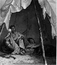
Smallpox was most contagious during the first week, but it could still infect others as long as the scabs hung on – which was typically a month. The infection could be conveyed by breathing on others, by touching an infected person, or touching contaminated materials including clothes and blankets. Corpses were contagious for as long as 3 weeks, and the clothes they wore could transmit the disease for as long as one year. By the time that settlers began to arrive in this area the tribes had been decimated. Many of the bands fell apart leaving their ancestral lands, sometimes moving in with the remnants of other tattered tribes. Trade and transportation routes collapsed. Local languages began to disappear as Chinook trade jargon and English began to replace the older languages. The renowned scholar, Henry Dobyens, that has done the greatest amount of work on establishing the actual population levels prior to contact, has estimated that in the first 130 years after contact more than 95% of the native peoples in the Americas perished.

It has happened, and right here in our midst!


Posted in Uncategorized | Leave a comment

You may never appreciate a clear-cut, but…

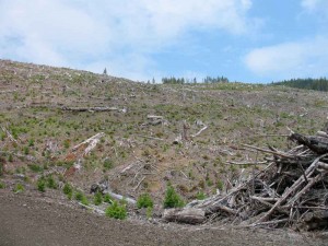
You may never appreciate a clear-cut, but there is more to this practice than merely wanton violence perpetrated upon nature.

For many people the sight of denuded hillsides is both depressing and incomprehensible. I won’t disagree, though I take a more hopeful view and choose to see these ravaged hillsides as evidence of the creative destruction that attends the harvesting of most renewable resource, whether it’s a field of tulips being harvested for your living room vase, windmills blighting the skyline, or biomass being incinerated and releasing more carbon into our atmosphere. All these processes are less than benign.

Let me clear, my intent in this blog is to try to explain one aspect of current forest practices. It is not to justify those practices. Since I frequently encounter clear cuts, I would like to understand how the forest practices “rules” are applied and whether they are applied correctly according to the current rule book,  the Revised Second Edition of the Oregon’s Forest Protection Laws.

Personally, I do think that trees represent a viable renewable resource. But I don’t believe that current economic realities favor a truly sustainable approach to forestry. In the long run I hope we can agree upon an equitable way of accounting for and including all the “external” costs associated with harvesting trees. This would include the cost of lost bio-diversity resulting from our mono-cultural planting practices. It should also include a tariff (and in some cases  a ban on certain materials) on natural products unsustainably produced and manufactured overseas. It should include a financial disincentive for reducing the quality of our water resources. It should include financial incentives to increase the protections that enhance salmon spawning and endangered species’ critical habitats; conversely it should impose financial disincentives for practices that degrade these habitat areas. Practices that can injury the health of our coastal fisheries should be penalized. And locations with native Indian values should be respected. There should even be some mechanism for addressing the value of these lands as recreational or heritage sites – that value can be degraded by too much cutting, especially in areas with distinct scenic or locational value. Establishing that these aspects of our forests represent real values and that forest practices can impinge upon them represents only the first step. It is probably unrealistic to expect the forest products industry to be able to offset all these values and still maintain it competitiveness in the world markets for wood products. So our solution needs to encourage a market place that is level and fair – that means insisting on international standards for natural resource harvesting that support sustainable harvesting and production practices.

I grew up in a forest community that only practiced selective logging – in the Austrian and Bavarian Alps. There logging took the form of continuous thinning and culling of the mature trees, a practice referred to as a “commercial clear-cutting”. In these alpine communities we enjoyed a silviculture that sustained a small coterie of foresters, but the economic impact was a fraction of what the wood products industry represents to the Oregon economy. Of course, the cost of wood in Bavaria and Austria is also much higher than it is in Oregon, which is why homes in the Alps are built of brick and rock, and are considerably more expensive than our wooden homes.

Some might argue that a selective harvesting approach and a more careful use of wood is more sustainable, but clearly such an approach wouldn’t sustain what remains of Oregon’s forest products industry and the rural communities that depend on it. Of course, our wood products industry is vested into the current system. But blaming the forest product producers is pointless. They’re just responding the the existing economic signals in the marketplace. What we should focus on is reforming the pricing mechanisms to include proxy values for the “external” values we wish to preserve or encourage. Whether these values are expressed as fees, quotas, tax incentives, or tariffs will no doubt occupy us for years, but the sooner we “price” these essential ecological values into the marketplace – the sooner we can provide industry with an equitable market place in which they can operate. And that could easily lead to a timber renaissance as equipment-intensive methods are replaced with more labor intensive customized harvesting approaches. And that could greatly enhance the quality of life in rural communities throughout Oregon.

Today, foresters argue that certain species, like our ubiquitous Douglas Fir tree requires lots of sun to grow and succeed in the competitive environment of a crowded forest. The Society of American Foresters argues that clear-cutting is “a method of regenerating an even-aged stand … in a fully-exposed microclimate after … cutting of all trees in the previous stand.” There are currently two accepted arguments for retaining clear-cutting: the economic argument and the growth related characteristics.

Here again, I personally would argue that we need to change the overall rules that determine pricing in the wood products markets to reflect the other external costs I mentioned in the previous paragraph. But it will take a much longer societal discussion to arrive at a consensus about what costs are valid to include, and how to reflect these costs in a way that permits the forest practices industry to thrive while still absorbing these costs. In the end wood will become more expensive as we add in all the external values we cherish. But that’s what it means when we say we really “value” our forests. To do less is to cheat ourselves, and lose our natural heritage in the bargain.

We may well decry the deforestation that our modern forestry practices inflict on the land, but we are by no means the first to do this. First let’s remember that forest fires are part of the natural selection process through which our majestic forests arise. Early travelers in the region reported that the summer months were renowned for the smoky haze that filled the Northwest valleys. It was said that by August the smoke from the forest fires was so thick that the Indians living around the Puget Sound were unwilling to canoe beyond sight of the shore, lest they get lost in the smoke. And of course the Indians, themselves were major contributors to that smoke. Most of the open savannahs that typify the Willamette Valley are a direct result of the controlled burning that the Kalapuya Indians used to expose the tarweed seeds and and acorns that lay scattered in the thick grasses that carpeted the valley floor. In the fall they were known to set the open areas ablaze to encourage a winter crop of grasses that attracted game and cleared the underbrush so that they could more easily spot their quarry. On the hillsides they burned the western facing slopes to encourage the growth of berry bushes and to provide clear areas that would attract elk and deer. The Indians were even known to burn fir trees fir for entertainment. On their return trip across continental divide, the Lewis and Clark expedition was entertained by Nez Perce Indians that set fire to some sap-ladened conifers, “which… creates a very sudden and immense blaze from bottom to top… They are a beautiful object in this situation at night. This exhibition reminded me of a display of fireworks”, Lewis wrote in his journals.

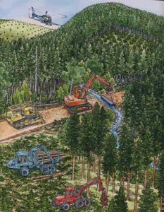
Ok, so we’re not the first to devastate these hillsides with our clearing techniques, but what else should we know about clear-cutting? This has been a question I have been unable to answer until I recently came across the Revised Second Edition of the Oregon’s Forest Protection Laws. This illustrated manual is produced by the Oregon Forest Resources Institute in a style reminiscent of “Where’s Waldo?” Its detailed illustrations will have you searching the forest scenery for the tell-tale red and white striped cap that Waldo wore. Though it seems that Waldo never made into the Oregon Forest, the manual’s many detailed illustrations are a goldmine of information about current Oregon Forest practices.

And it is from this useful manual that we learn that there are at least four types of clearcut. The first thing to know about clearcuts is that they are regulated by size and the fertility of the area. The North Coast Range generally falls into the most productive site classification for forests. In all cases landowners are required to reforest their timber lands. In addition they are required to keep a certain number of wildlife trees and downed logs to support the regeneration of the diverse species that rely on the forest. It is this final requirement aimed at the preservation of wildlife species that distinguishes the types of clearcuts visible in our forests.

In a Type 1 clearcut (see illustration nearby) the landowner retains approximately 50 trees per acre with an 11″ diameter, this permits him to avoid having to keep additional “wildlife trees” and down logs. He is, however, still obliged to reforest the site within two years. This type of clearcut is infrequently seen. In comparing this category with the following harvest types, I’m not sure I see the a clear distinction between this type of harvest and Type 3.

In a Type 2 clearcut, the landowner elects to retain an adequate number of “seedlings, sapling and poles” (young tree with diameter up to 10 inches). That’s either 200 seedlings, or 120 saplings or poles, or 53 trees with a minimum 11 inch diameter – or a combination thereof. In this case, the reforestation standard is met and no further reforestation is required. However if the site is larger than 25 acres, it will still require the retention of of two wildlife trees and two downed logs per acre. This type of clearcut is even more rare in my experience. I suspect this is because mature Douglas Fir forests typically suffocate any immature trees that could serve to fulfill the required quota of seedlings, saplings, and poles.

The most common clearcut is the Type 3 harvest. In this case few, if any seedlings, saplings, poles or other larger trees remain. In this instance the harvester must reforest the land within two years and curiously there is no requirement to leave wildlife trees or downed logs – unless the site is larger than 25 acres. Not surprisingly, this is the most common clearcut variety that I have seen.

Finally, we have “commercial thinning” which is considered an “Unclassified Harvest”. In this instance the timber harvesters are selectively thinning the forest to permit the remaining trees to have more room and access to sunlight and therefore grow more quickly. In such cases there will be more than 50 trees with a diameter of 11 inches remaining per acre, so no wildlife trees or downed logs will be needed, nor will reforestation be required. This kind of selective logging has been prevalent in those areas that are growing timber for structural purposes, but in recent years many wood products companies have switched to selling their wood into the pulp and fiber markets where there is no premium for tall and strong wood. In these cases, the timber harvesters have stopped thinning and simply harvested these overgrown hedge-rows for their bulk “fiber” value.

It’s been said that it’s difficult to see the forest for the the trees, but perhaps the foregoing will help you see the clearcut more clearly despite the lack of trees. And to begin thinking about how to develop a marketplace for forest products that has absorbed the true costs associated with forestry practices, and has deployed the incentives and disincentives needed to preserve the natural resiliency of our ecosystems.

Posted in Indian lore, Logging history, Uncategorized | 3 Comments

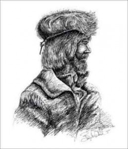
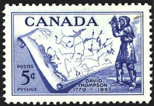
Rediscovering David Thompson: he mapped the transcontinental canoe route down the Columbia River!

The shadowy fog wreathed London in that gloomy winter of 1783. Its chill dank air permeated into the austere schoolroom and gripped at the hearts of the two boys that stood stiffly before the visiting Secretary of the renowned Hudson Bay Company. The oldest boy, Samuel John McPherson was apprehensive. He knew that the school’s board of governors was anxious to seek apprenticeships for its older boys so that the school could accommodate more children whose lack of education might otherwise doom them to a dismal future in Dickensian England. Alongside him stood David Thompson, a shy welsh boy, whose arrival at the school had been precipitated by the untimely death of his father shortly after the family’s arrival in London.

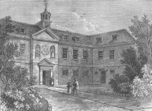
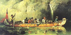
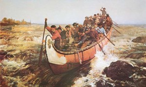
Standing before them that morning was the austere Secretary of the Hudson Bay Company who inspected them, while explaining to the school master that the Hudson Bay Company maintained trading stations throughout the wilds of North America from whence they extracted a fortune in beaver pelts. Frowning sternly, he explained, it was not enough to employ the sturdy Orkney and Hebrides men that navigated their canoes up the wild rivers of the north. To run this business, the Hudson Bay Company needed clerks to record and manage the trade – currently they were in dire need of new clerks! Not wishing to snub a benefactor, the school quickly nominated both Samuel and David, and they were told to prepare for their imminent depart from England and all that they had ever known. Samuel immediately fled and disappeared into the murk of history, but the following May David Thompson bade farewell to his mother and remaining siblings and boarded the Prince Rupert for the passage to Churchill, the HBC’s main base on the western shore of Hudson’s Bay.

Arriving in early September the Prince Rupert took on its cargo of canvas wrapped fur bales and soon prepared to return to England. Many years later David recalled the sense of isolation that he felt as he stood on a pile of barren rock and watched the ship that was his only link to all that had been familiar recede into the distance, “While the ship remained at anchor, (the separation) from my parents and friends appeared only a few weeks distance, but when the ship sailed …the distance became immeasurable and I bid farewell to my country, an exile for ever.”

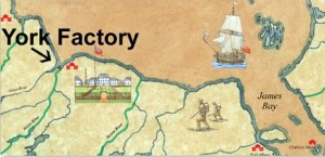
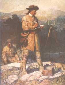
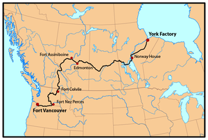
The boy would spend the next year learning the fur trade behind a 12’ stockade that enclosed a weather-beaten cluster of unpainted huts perched on the banks of the cold and muddy Churchill River, just above where it flowed into Hudson’s Bay. In September 1785, he was transferred to York Factory situated near the mouths of the Nelson and Hayes Rivers – a six-day journey from Churchill. Aside from these two posts located near the navigable Hudson Bay, the Hudson Bay company had recently established three trading posts further inland: Cumberland House, Hudson House and Manchester House situated along the Saskatchewan River. These outposts were designed to counter the competition that the company was experiencing from the French Canadians who ignored the HBC’s exclusive trading rights throughout the vast northern interior. It was this encroachment by the French Canadian voyageurs that launched David on his epic explorations westwards when he agreed help establish a new inland trading post located 67 days westwards by canoe – just beyond HBC’s westernmost outpost at Cumberland House. During his sojourn in Cumberland House, where he was convalescing from a badly broken leg, Thompson was introduced to the craft of practical astronomy. Over time, he became adept at this celestial method for determining both longitude and latitude so that he was able to make reasonably accurate maps of his explorations. In 1797 it was these skills that brought Thompson to the attention of the Montreal-based North West Company, who promptly hired him to survey their trading routes.

Ever since the French-Canadian explorer, Peter Pond had opened the way westwards for the voyageurs in 1778-1779 with the opening of a canoe route over the continental divide, the race had been on for their competitors, the Hudson Bay Company and the Northwest Company to find competing routes into the western portions of the continent. In 1789, William McKenzie began searching for the fabled Columbia River, but ended up on the Artic Ocean instead. In 1792 he tried again and this time he discovered a mighty westward flowing torrent that the Indians called the Tacouthe Tesse, but he was unable to follow it due to impenetrable terrain. In 1792, Captain Gray finally penetrated the violent Columbia bar finally establishing that this massive river was navigable deep into the continent. In 1804 the Northwest Company decided to send Simon Fraser to reconnoiter McKenzie’s Tacouthe Tesse – to see whether it was the source of the Columbia River. This tumultuous stream, later renamed the Frazer River, proved impossible to navigate and difficult in the extreme to even follow on foot. In 1805, the Lewis and Clark expedition traveled the lower reaches of Columbia River and confirmed that it was navigable nearly all the way to the Rockies. Finally, in 1809 John Jacob Astor began negotiations with the Northwest Company about possibly collaborating to open the fur trading routes in the far west – not to gather the pelts for the European market, but instead to ship them to China. The negotiation eventually foundered, but that did not keep Astor from sending his own overland team to the Columbia River where they were supposed to link up with the Tonquin, which set sail in the fall of 1810. There they planned to establish the first American outpost and secure the Columbia River for the American traders.

And so it should not have come as a surprise to Thompson that his employers, the Northwest Company now felt some urgency about laying a credible claim to the Columbia River. But David Thompson was taken unawares when he received instructions in 1810 seek the headwaters of the Columbia by means of ascending the Saskatchewan River. At the age of 40 years he had thought it time forsake the fur trade to which he had already devoted 27 years of his life, living under extremely primitive and dangerous circumstances. He had planned to travel back to Montreal and settle there with his family. But when the summons arrived to organize this final expedition, Thompson realized that it represented the capstone of all his prior efforts and agreed to lead this final effort to locate the headwaters of the Columbia River.

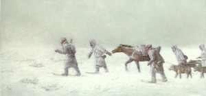
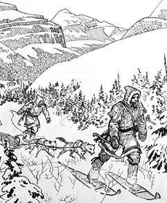
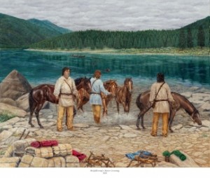
In a mere days he assembled his expedition comprised of six canoes, twenty-four men and six thousand pounds of trade goods. They traveled up the Saskatchewan River, but blocked by aggressive Piegan Indians, the group struck north on an old Assiniboine trail taking a month to cover the 110 miles to the Athabasca River. Now, just fifty miles from the mountains they camped for nearly four weeks while they built sleds and crafted snowshoes to help make a dangerous mid-winter crossing of the Rockies in temperatures that dipped daily to minus 30 degrees or more. On the 29th of December 1810, twelve expedition members clothed in woolens and leather outer garments and accompanied by eight dog sleds and four packhorses began the long climb through the deep snow into the huge fastness of the continental divide.

Several of the French Canadians in the group were soon spooked by the vast expanse of huge looming mountains that dwarfed their puny presence. They became convinced that mammoths roamed these snowy valleys and would soon gore them with their huge curved tusks. With the greatest difficulty and urgent persuasion, Thompson was able to keep his group together until they descended the western slopes to the banks of the Columbia. But once there the recalcitrant French Canadians once again refused to proceed, and announced that they would turn back. Left with only three companions Thompson was wise enough not to proceed onwards through the territory of Indian nations that had probably never have seen a white man before. So he turned northwards to resupply at several outposts that he had previously directed to be built near present-day Kalispell and Spokane.

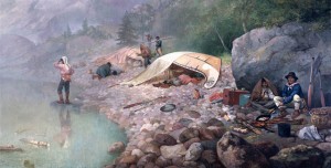
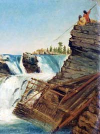
After resupplying and recruiting more reliable companions, he resumed the southward journey with five remaining French Canadians, two Iroquois, and two Salish speaking interpreters. From Spokane House they traveled northwest to the Columbia River, where they encountered nearly a thousand Indians gathered for the fishing at Kettle Falls. Here they build a cedar canoe and on July 2nd, they resumed their epic exploration, “to explore this river in order to open out a passage for the Interior trade with the Pacific Ocean”. Although Lewis and Clark had traveled and surveyed the lower Columbia River, the portion of the river ahead of them was now completely unknown to any European travellers. By surveying this unknown stretch of the river and proceeding to the mouth of the river, Thompson would soon become the first explorer to travel the entire length of the Columbia River.

From here on out their travel was accelerated by the pace of the river they were following. Along the way they visited with numerous tribes to learn about the local circumstances and to trade for food. Leaving the territory of the Salish speakers, they were now swept southwards for one hundred and forty miles through a high arid plateau. The Indians they encountered on this desolate stretch of the river lived on roots, berries and salmon and were, according to Thompson, “too impoverished to wage war”. In early July they arrived at the confluence with the Snake River, where the river made a huge turn and began its final journey to the coast and into the Pacific Ocean. From here on they began encountering signs of prior contact such as spotting the bronze medallions handed out by Meriwether Lewis six years prior. Indeed, from here on they soon began to encounter Indians with increasing frequency camped along the river’s shores harvesting the fall salmon runs.

As the river gathered force they were swept downstream on the powerful currents that roiled the river, surging into massive rapids as it was forced through narrow constrictions, and increasingly hemmed in by towering black cliffs. Thompson wrote that, “imagination can hardly form an idea of the working of this immense body of water under such compression, raging and hissing as if it were alive”.  But once through this massive portal, Thompson and his men were astounded to see the countryside turn into verdant forested mountains with fantastic waterfalls cascading into the River. Even the Indians were different here. Not only were they shorter and stockier, but they also seemed to eschew any clothing whatsoever! And they spoke a language unknown to Thompson and his Salish-speaking interpreters.

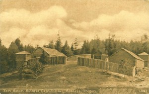
Finally, on July 15 the group approached the mouth of the river. Here they took time to tidy themselves up before approaching the settlement that Astor’s men had established only months previously. A few miles onwards they finally spotted their destination – a small clutch of huts clustered together in a small clearing and surrounded by gigantic forests that dwarfed their presence and almost ridiculed the tiny fluttering flag that few above the settlement. This was the Americans’ first settlement in Oregon only 4 months after it had been carved from the primordial jungle!

Needless to say, the Americans were quite surprised to receive such visitors. They had themselves been preparing to launch an expedition to go upriver when they spotted the large canoe rounding Tongue Point. As it approached a British flag was spotted fluttering from the stern. In the boat were several gaily attired voyageurs and at the rear a neatly dressed man that appeared to be their leader. Landing at the community’s newly built wharf, the leader sprang out and without hesitation announced himself as David Thompson, a partner in the North West Company.

The group was heartily welcomed and feted all around. While the arrival of this arrival of a British contingent on the western shores of the continent occasioned much conviviality, the strategic message was not lost upon its participants. The arrival of representatives from one of the most successful trading conglomerates could only portend increased competition for the natural resources the American hoped to secure. And history would soon prove those that understood these strategic dimension correct. Within a few years the Hudson Bay Company would dominate trade on the Lower Columbia and Astoria itself would soon change hands and the flag rippling in the coastal breeze would soon sport a Union Jack.

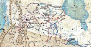
We don’t know exactly what was said at this historic meeting on the sunny shores of the Columbia, but if only we could remind David Thompson how far he had come, both literally and figuratively, from that dank December day nearly 28 years ago when his destiny was peremptorily altered. Since then he had been transformed from a shy Welsh youth, to one of the world’s foremost explorers, and now the first man to navigate the mighty Columbia from its source to the Pacific Ocean. Not only had he traveled from Europe into the wilds of North America, but he had also explored more than fifty thousand miles of rivers and trade routes extending across the entire North American continent. It seemed, at that moment, as if his name had been writ large into the great book of accomplishments.

Much would change in the Pacific Northwest over the coming decades and the capricious memory that we call history would exalt some while overlooking others. The accomplishments of Lewis and Clark would come to rank among the nation’s highest achievements. Names like Simon Frazer and Alexander Mackenzie provided the superlative adornments to Canada’s exploratory history, but David Thompson was destined to eventually die penniless and unknown long after his retirement in Terrebonne, a village on the outskirts of Montreal. It has only been in the last few years that his incredible achievements have been resurrected by in such worthwhile historical accounts as D’Arcy Jenish’s book The Epic Wanderer, and Jack Nisbet’s The Mapmaker’s Eye.

But for those of us that live along the Columbia River, we should add this scrappy Welshman to our pantheon of explorers for not simply completing the first source-to-mouth navigation of the Columbia River, but also for the over fifty thousand miles of exploration that he accomplished over his 28 years of wandering through the northwestern regions of this continent. As one who himself has undertaken just a minuscule scope of exploring the watersheds of Northwestern Oregon, David Thompson stands out as a shining example of diligence, perseverance and intelligent observation along the way.


Posted in Pioneer Lore, Uncategorized | 3 Comments

Hurting the earth as little as possible – in memory of Randy Hodges

In the 1998 edition of  The Pacific Crest Trail Hiker’s Handbook, Ray Jardine admonishes us that trail building should, “try to hurt the earth as little as possible”. The overriding objective should be to keep the wilderness experience as natural as possible. The trail engineering should blend in so that it can be overlooked as we focus on the natural environment around us. Like so many things in life the ultimate compliment that can be accorded our work is that it blends so perfectly with the world around us that the human intervention is all but invisible.

Such a trail builder was Randy Hodges! He had a reputation as an exceptional contributor to this solitary field of trail construction.  On his business website Randy cited this accolade, “There’s a lot of guys who call themselves trail builders, but they’re not like Randy. He’s an artist.” Having walked his trails I will not disagree.


But on February 17, 2011 we lost Randy Hodges – on of Oregon’s most respected trail bui
lders – as he worked on the trail from Gales Creek Campground to Reehers Hose Camp, near Timber. He was carving a trail into  a bluff of exposed, weathered and fractured rock. A rock from above came down and hit his equipment and him, pushing them both off the trail and down about 30 feet to a rocky ravine. The tractor landed atop of Randy.  Because he always worked alone, he had no chance for rescue. The accident probably happened a day or two before ODF found him.

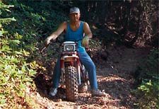
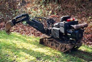
 Above you can see the tools that Randy and many of his fellow mini-road builders use (Morrison Trail builder and Honda Carrier), but what really set them apart is their vision for integrating a passable route through the challenging terrain so that we hardly even notice. So the next time you go strutting up a trail give a little thanks to the enterprising souls that spend their lives working all alone on some lonely stretch of forest to thread a lifeline through the jumble of wilderness.


Posted in Misc Trails & Trips, Salmonberry Trails, Uncategorized | Leave a comment

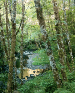
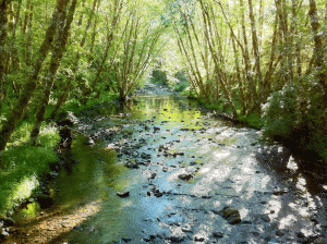
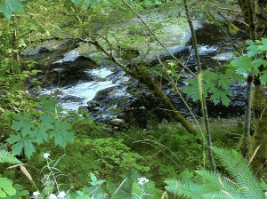
Rock Creek – one of the prettiest streams in the North Coast!

If you drive to the very back of McGregor Road (off of US 26) there a small clearing just before the road splits into the Eastside Grade and the Pit Road. The McGregor Road climbs the ridge from its access point on US 26 (a quarter of a mile east of the rest area). Albeit at a distance and at a higher elevation, the Mcgregor Road parallels the gated logging road that leads to the original site of Camp McGregor – now a tree farm operated by Stimson Lumber Company.

This road eventually leads into timber tracts that were originally controlled by the Eastside Logging Company – to supply their box making factory in Portland. Hence the furthest extension of this road is also called the Eastside Grade. The alternative route, simply identified as the “Pit Road”, is also known colloguially to the foresters that maintain these routes, as the “Snagpatch road”, in honor of the many storm-toppled trees along its length.

Rock Creek

However to get to Rock Creek, you will have to back up about 50 feet from the Y fork in the road that splits McGregor Road into the two aforementioned choices. To the left of the car will be a wide open area and in the NE corner of that clearing you should spot a rough track heading north. Follow this track past the water filled quarry and enter into the deep foliage that threatens to press in on the car. From here this rough track continues down the north face of this mountainside, switch-backing back and forth until it forks near the bottom of the slope.

If you proceed straight ahead you’ll eventually emerge along the lower portion of Rock Creek and will be blocked by a gate just short of the bridge over Rock Creek located east of Ginger Creek. If you turn left the road parallels Rock Creek in the upstream direction. Eventually this road also is blocked , just short of the bridge across Rock Creek. But if your car is the more of an urban vehicle with minimal clearance it would be best to park it before the big hump in the road. From there it’s just a matter of following the road over the bridge and following the stream. There is an uphill option soon after the bridge, but ignore that and hang left to pass through a narrow defile that marks the continuation of the original railroad grade that carried timber out of this valley. Further along the road has been obliterated by earth movement and the encroachment of a stream, but these impediments can be easily navigated on foot.

The road follows this idyllic stream all the way to US 26. It’s 3.47 miles to the next bridge and from there it’s another 5.75 miles to US 26. On foot the walk to the next bridge and back was quite enough!

Posted in Misc Trails & Trips, Saddle Mountain Trails, Uncategorized | 4 Comments

Wishing for a mattress sandwich on a hot August day…

In pre-contact days our nature was stable, clean and nurturing…

Finally, it’s getting decently hot in Oregon! This is the time of the year when our landscape begins to burn up around us. So far this year we’ve been blessed by a remarkable lack of wildfires and uncontrolled forest conflagrations, but for that very reason it might be good to remind us all of what it was like in bygone years.

Perhaps you’re of the opinion that during those “idyllic” pre-contact days our Kalapuyan, Clatsop, Clatskanie and Chinook predecessors enjoyed a state of nature that was stable, clean and nurturing.

Nurturing…!

No doubt the last of these was generally true to the extent that the Pacific Ocean and the Columbia River provided these inhabitants with diverse and nutritious protein, in the form of fish, venison and abundant berries.

Stable…?

As to “stable”, it appears from the archaeological record that this region was beset by numerous violent changes in the configuration of the earth’s crust – enough to bury whole villages and to sink or lift portions of the coastal plain above or below the sea level – playing havoc with our coastline and natural subsistence patterns. Imagine how you would feel if one morning you awoke to find that the entire lower Columbia estuary, including the Portland area was inundated! Sea levels once rose to levels almost 100 feet above their present levels…and before that they were so low that Vancouver Island was connected to the mainland.

Indeed it is thought that the earliest migration of peoples into North America (around 16,000 years ago) may have occurred along the edge of the Pacific Ocean, as early explorers edged along the unfrozen fringe of our glacial continent. Because the glaciers locked up so much moisture in their gigantic frosty blankets, the sea levels were significantly lower than they are today. Thus it is very possible that the clues to support theories of coastal migration lie almost 100 feet below today’s sea level.

But with the melting of the glaciers came an onslaught of water rising deep into what is now the interior of the West Coast. But even that eventually receded to “stabilize” at our present-day sea levels. But if melting glaciers caused this inundation in the first place, what should we expect with the accelerated melting we’re experiencing today? Should we expect many of the coastal plains around Astoria, and Cannon Beach to be submerged?

Clean…?

August days in the western valleys of Oregon and Washington were hazy and smoke-filled. Theodore Winthrop, the noted Civil War era journalist, noted in his 1853 descriptions of traveling across Puget Spund and the Cascades, The Canoe and the Saddle, “in the breezeless days of August, smoke from burning forests falls and envelopes all the world of land and water. In such strange chaos, voyaging without a compass is impossible. Canoes are often detained for days, waiting for the smoke to lift“.

Not only did the natural forest fires fueled by lightning strikes burn unabated through out the coastal and Cascade ranges, but the Indians themselves contributed by burning swathes of open ground into the impenetrable forest blankets that threatened to smother the burgeoning populations of elk and deer. These artificial clearings were repeatedly burned to ensure riparian areas for the animals to graze and the Indians to hunt. They even burned the west-facing slopes to permit huckleberries to establish themselves in the disturbed ground left behind after the conflagrations. And in the Willamette Valley the Kalapuyans were masters of the pyrotechnical tool. They burned extensive areas of the Willamette Valley to replenish the growth of grasses, whose seeds they collected. They burned the plains to clear the ground for oaks and filbert trees, whose nuts they valued. In short, the beautiful savannah lands dotted with copses of old oak trees that we admire as we drive down the valley – these are all the results of yearly fires that filled the region with hazy August smoke that would panic today’s asthma sufferers.

And more recently, Oregon’s North Coast history is dominated by the huge Tillamook Burn fires that consumed so much wood from the 1930’s into the 1950’s.

Ten thousand of the best men that ever wore calks could never have done as we did..

The great Tillamook Burn of 1933 has received a lot of attention, but it is often forgotten that during that same year another fire, the Wolf Creek Fire burned a total of 47,000 acres of timber and reduced Camp McGregor to a heap of smoldering ashes. It is thought that the fire broke out in some unburned slashing on the East-side Logging Company property in the late afternoon of August 24th, 1933. Men and equipment were rushed by train from Vernonia to the scene, but a rapid change of wind direction and an increasing velocity of wind soon caused the fire to jump beyond the firefighter’s lines. The wind rising to gale proportions soon whipped the inferno into a frenzy. During the late afternoon of August 26th, the wind suddenly reversed direction and began to blow at near-hurricane strength – directly threatening Camp McGregor itself. The firefighters rallied and initially thought that they could save the community, but the force of the wind and the fire that it drove before it was unstoppable – especially after a fallen tree broke the pipeline that supplied water to the community.

Judd Greenman recalled the scene in the book, The Oregon -American Lumber Company: Ain’t no more, “this fire crowned whole sections of timber; it spotted ahead as much as two miles at one jump and it burned downhill and against the wind, so you know it did an enormous amount of damage. We never had a chance. Ten thousand of the best men that ever wore calks could never have done as we did – stood and watched her go.

One 17 year boy recounted how he was forced to snatch 2 mattresses from the bunkhouses and after quickly soaking them in the pond, he lay sandwiched between them while the fire raged over him.

As the authorities realized that saving Camp McGregor was hopeless they ordered the residents and the CCC crews to evacuate by train. But the CCC boys, being mostly from urban eastern locales, panicked and tried to force the families off the train until it was made clear that there was room enough for everyone. Within one hour the entire Camp was engulfed in flames and burned to the ground – the walkways that connected the houses caught fire like a fuse leading the conflagration from one cabin to the next! The fires didn’t burn out until September 5th when the rains finally arrived.

So when the heat of August begins to fry your pelt, and the humidity drops to dangerously dry conditions remember the “hazy August days” of Oregon’s bygone days…

Posted in Indian lore, Logging history | Leave a comment

Gyppo logging

In the summer I often get out into the woods during the work-week which occasionally finds me having to contend with the loggers that make their living in these same forests. As you have probably realized by now, this writer tries not to takes sides on the debate of whether logging is good for our community or not. I will leave it to others to determine what are good forestry practices and what aren’t – and I hope they make prudent choices that allow the forest to be valued for its many eco-system services, not just exclusively its recreational values or its industrial values.

That disclaimer aside, let me also admit my fascination with the rough-hewn independence of our brawny Northwest logging culture.  And nothing exemplifies that more than the quintessential Pacific Northwest tradition of the “gyppo logger”.

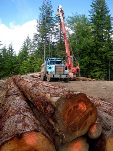
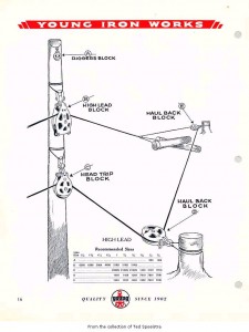
In the Pacific Northwest, the tradition of assembling small bands of entrepreneurial woodsmen harkens as far back as the adventures of the American Fur Company and more recently the infamous “Wobblies” of the early 20th century. The most recent incarnation of that pioneering spirit can clearly be found amongst that small scruffy segment of the forest products industry colloquially known as the “gyppo loggers”. Gyppo logging usually refers to a small, independent “outfit” of lumbermen that have contracted out the harvesting of timber. Typically, such an “gyppo show” will number no more than a dozen rugged woodsmen using battered skidders, loaders, caterpillars, a fire truck, a “crummie” to haul the crew in and out, and a portable yarding tower to pull massive amounts of lumber out of the most difficult terrain imaginable.

The term gyppo originally derives from the old railroad building days when groups of laborers would desert their employers only to form a small cooperative that competed for the work contracts, thus “gypping” their former employers of the work. The success of these entrepreneurial companies is due to work hard, keeping costs low and undercutting the bigger operators by just enough to win the bid, but not so low as to lose their profit – it took both experienced cost estimation and an experienced and determined crew.

At the bottom of the logging show’s hierarchy is the chocker setter, who spends his day dragging a thick “chocker cable” across the steep slope of fallen trees.  This is exhausting and dangerous work clambering through the poison oak, the devil’s club and the dense tangle of vinemaple branches. All around them are newly “bucked” logs (stripped of branches) lie precariously intertwined on the steep slope. Dragging the chocker cables behind him, the setter then scrambles underneath the precariously perched logs and wraps the heavy cables around one end of the fallen log. Once attached he scrambles back seeking relatively safety away from the collared trunk and issues two blasts on his radio to signal to the yarder that he can tighten the “skyline”.

With a throaty roar the yarder’s winch tightens the skyline and this massive cable lifts off the slope with the chocker cables dangling off it like massive leashes dangling from a laundry line. As the skyline tightens high above the slope, the logs tethered to the chocker cables lurch off the debris-strewn slope. The choker setters watch this process warily as other logs are shifted and slide into new configurations. If too much strain is put on the chocker cables they can snap tossing these huge lengths of lumber onto the slope as if playing a giant’s game of pick-up-sticks.

At the other end of this cable sits the yarder operator. He’s the one that has to carefully raise the cables and ensure that the collared logs rise off the slope without snapping the cable, dislodging other logs. If the cables extend too far to either side it might put too much lateral pressure on the line. That’s when it needs to be moved. Using a caterpillar they will relocate the distant anchor point about 5 degrees beyond the prior position. There they will anchor it to a new stump, and then rearrange the tail blocks and rigging to achieve the right declension over the canyon.

Once the double bleeps of the radio signal that the logs have been fastened the yarder fires up the winch and begins to haul the dangling logs up the slope and deposits then on the nearby loading deck.

That’s where the loader operator demonstrates his skills: sorting the logs, stripping off the remaining branches and loading them on to the waiting log trucks. The loader resembles a huge battered crab from whose elevated arm dangles an enormous claw. The claw can be flung up to fifty feet to clutch at logs strewn across the loading deck – that large flat area resembling a helipad upon which the gathered wood is dumped. Like a beaver inspecting his trove of sticks, the loader hoists his logs closer for inspection and sorting. Sliding the clamp deftly down the trunks he strips off the remaining branches and then tossed the log aside for later loading or he carefully positions it onto the back of the waiting log trucks. If the wood is not of sufficient quality it will go to the plywood mill, otherwise it will go to the mill that cuts the structural timber. Sorting the wood effectively can make or break a gyppo operator.

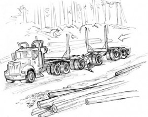
A single logging show can produce an average of a dozen or more log truckloads per day – or the equivalent of enough wood to complete 5 new homes. Truckers get paid by the load – averaging around $150 per load. Since they need more than $300 per day to cover their costs, they have to complete at least three loads per day. Usually the truckers work in rotation, so that hopefully they can achieve their desired quota every other day. But key to this regimen is getting the logs to the mill as quickly as possible, thus increasing the chances of snagging another load before shutting down for the night. This is why the loggers are known to race down the logging roads as if they owned them – which in fact they do! If you’re brave enough to navigate the logging roads during the weekdays, keep your head and give these barreling giants the biggest berth you can. Despite my years of experience driving these roads, I avoid active logging routes as much as possible and when that’s not possible I honk approaching every blind corner and hug my side of the road to make as much room as possible for the trucks. Remember that’s more than 40 tons of truck and logs coming at you!

Posted in Logging history | 8 Comments

Spring is here; the Trilliums have arrived!

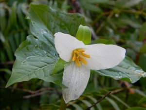
This iconic flower is frequently all that heralds our Pacific Northwest spring, since the common characteristics of this vernal season, like warming weather and diminishing rain are so often missing in our chilly jungle.

March 8th dawned clear and sunny which was all I needed to clear my calendar and scramble up into the woods to witness the first buddings of greenery, the steam wafting up from the warming soil, and the excited songs of the birds harvesting the soft soil for the emerging insect life – which brings me back to the flowering trilliums punctuating the dark forest floor with their white and yellow accents.

The trillium’s yellow stamen is covered with a gummy matter that clutches the plant’s precious seeds. But forest ants are known to adore this small, white structure joined to the seed called an “elaiosome,”. This structure is rich in oil and emits a chemical that attracts ants. After the ants eat this trillium treacle, the seeds that have stuck to them are discarded in their tunnels where they later germinate. So now I begin to understand that when Loki leaps back into the car entirely covered with springtime mud, we are merely bit-players in a universal plot to shuffle millions of biological pawns across our endless chess game.  If this were ever to stop we’d be at the end of our existence, so appreciate the life preserving message behind the seed covered in stickiness and and your mud encrusted pooch.

The trillium has always been a favorite of Indians and settlers alike. I was discouraged from picking it by the apocryphal tale that severing its stem would so discourage it, that it wouldn’t return for another 7 years. But the Quinault Indians had a more effective precautionary tale for their blossom snatching children. Pick a trillium and you were guaranteed to make it rain – a pretty safe bet for residents of the lower Columbia River in early April.

On this early spring day I set out to walk the final two trails on US 26 between Portland and the coast. Of course, I have been traipsing all across these hills and mountains for the last 5 years, but somehow I saved the only two “established” trails for the bitter end. And today I decided to explore these official Tillamook State Forest trails:

  • Four County Point trail
  • Steam Donkey Trail

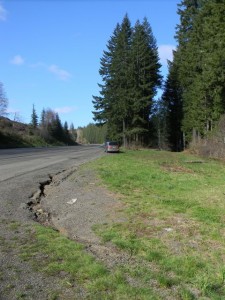
The Four County Point trail is located about 39 miles out of Portland. A highway sign gives ample warning that there is a hiking trail ahead, and just as the road turns and begins to ascend you will spot an additional sign alongside the road, where a wide should accommodates parking for at least a dozen cars.

The official brochure from the Tillamook State Forest claims that this is the only place in Oregon where you can stand simultaneously in four separate counties: Tillamook, Clatsop, Columbia and Washington counties. My reaction to that is “big effing deal!” There’s so much more to this nifty 1 mile trail than contemplating some virtual dot on a map. But if that’s what it takes to get you out of your car and into the woods this trail may be the catalyst to helping you get a new life and a healthier perspective beyond the contemplation of political lines in the sand.

The trail itself winds through a Douglas-fir forest mixed with Vine maple, Salal, Oregon grape and Sword ferns. The North Fork of Wolf Creek runs alongside providing beautiful stream-side vistas. Follow the trail down and around before heading uphill parallel to the road. You eventually connect with an access road, but the trail diverges from this road at the top of the next hillock. The trail is relatively flat and well maintained so it can be navigated by most people without undue burden. On the way back you can stay on the access road which leads up the slope to the road, bypassing the lower portion of the trail.

This is a nice hike to take visitors on. It will add an hour to your day-long beach excursion, but will give them a lovely impression of our deep forests – something at least as dramatic to appreciate as our lovely coastline.

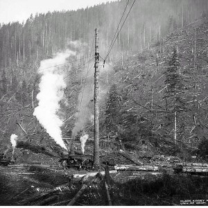
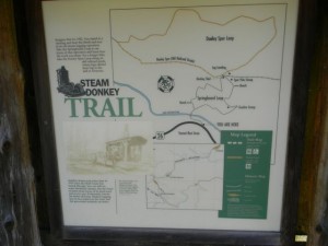
For another short hike, the Steam Donkey Hike at the Sunset Rest Area is equally recommendable. Configured like a figure 8, these two short trails comprise an interpretative trail that attempt to give you some idea of what it was like to log these hills in the early 20th century. As an “interpretive trail”, I think the concept fails to connect. But as a walking trail that shows off the huge stumps of yesteryear and the charm of our deeply shaded forests,  the Springboard trail (.3 miles) and the upper Dooley Spur Loop Trail (.5 miles) easily succeed.

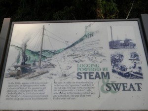
Both trails are well maintained and there is a nice bench near the interpretive sign at the midpoint of the figure 8 – where the two trails join. The signage does give a good description of the logging rigging that was used, but it’s unfortunate that they could not leave an actual old steam donkey in situ to help bring this early logging technology to life.

The fact that the hills all around have now been obscured by the new growth which makes it more difficult to envision the scale of the operation when it was operating in the 1920’s.

But the walk is certainly to be recommended. I’ve driven by this rest area for years and have never stopped to consider this little trail. Now I will cheerfully recommend it as a very worthwhile diversion for the 20-30 minutes it takes to circumnavigate the two trails!

Posted in Indian lore, Plant lore, Saddle Mountain Trails | Leave a comment

In some places March may “go out like a lamb”, but not here.

In some regions, March is said to “come in like a lion and go out like a lamb”, but here in the Pacific Northwest that’s hardly accurate as this early spring excursion to the Washington Coast demonstrated!

But if you wait for the weather to be clement, you’ll never get out. So that’s why James Benson and I planned a trip to explore Island Lake on the Long Beach Peninsula on March 24th – come hell or high water. We knew that it might be either or even both of these options, so I’m very glad we didn’t have any high water, especially in the form of a Tsunami, because the Long Beach Peninsula would be an absolute death trap in such a disaster.

As for the more benevolent versions of precipitation, we managed to find a relatively dry spell for our exploration of Island Lake – one of the long finger lakes that extends up the center of the long peninsula. I was particularly interested in visiting this lake since the Columbia Land Trust, on whose board I sit, had recently acquired a large tract of land between Island Lake and Loomis Lake – just a skip and a muddy splash further west.

To reach Island Lake travel down to the Southwest corner of Washington State and then drive up the long isolated peninsula, known as Long Beach, Washington route 103. Turn right onto the east-west oriented arterial, Cranberry Lane. About a half mile onwards, turn north (left) on to Birch Road and follow it until you reach a chained off barrier – to your right the road turns and circles around at the waters edge forming a nice put-in point for any small craft. The Columbia Land Trust does ask that you notify them if you plan to use the lake, but it looks as if this hidden interior lake gets occasional from the local inhabitants.

The Long Beach Peninsula and Willapa Bay were originally discovered on July 5, 1788 by lieutenant John Meares in East India company ship, the Felice. Having failed to identify the mouth of the Columbia River, Meares sailed north. Meares sailed north where he discovered the entrance to what was later called Shoalwater Bay. He sent his long boat into the mouth of the bay, anticipating that the entrance to the bay was full of dangerous shoals and swept by strong currents. But the unanticipated danger proved to be the Indians that promptly attacked the long boat as it tried to enter the bay. Meares abandoned the effort and sailed north to continue searching for the great fabled western river called the San Roque by the Spanish explorer Heceta, and later named the Columbia.

In 1851 white settlers entered the area and discovered the oysters. The following year James G. Swan arrived and began to describe life on Shoalwater Bay in his classic account of life on the western frontier, now published under the title, The Northwest Coast. In it he describes the peninsula as a “flat, marshy and sandy plain, elevated but a few feet from the water’s level, and covered, as is the whole region around the bay, with a dense growth of gigantic forest trees, principally spruce fir and cedar“. His accounts of life among the Indians on Shoalwater Bay are among the best descriptions of Northwest Indian culture to be found, with intelligent observations interspersed by touching stories that bring these early settlers and their indigenous neighbors to life in a way seldom seen in the dry accounts of those days.

One particular passage comes to mind in which Swan is relating the Indian approach to paddling their canoes, the ubiquitous means of transportation in this semi-aquatic landscape.

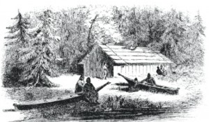
“We could have reached home easily, but as there was no occasion for haste I preferred to travel just as the Indians were used to going, without hurrying them up continually, which only vexes them to no purpose… When in the canoe, all hands will paddle vehemently and one would suppose that the journey would be speedily accomplished, the canoe seeming almost to fly. This speed will be kept up for about 100 rods, when they cease paddling and all begin talking. Perhaps one has espied something, which he has to describe while the others listen; or someone thinks of some funny anecdote or occurrence that has transpired among the Indians they have been visiting that has to be related; or they are passing some remarkable tree or cliff or stone which has a legend attached to it and which the old folks never can pass without relating to the young, who all give the most respectful attention.When the tale is over, the steersman gives the word “Que-nuk, que-nuk, whid-tuck” (now, now hurry) when all again paddle away with desperate energy for a few minutes, and then the same scene is enacted again.

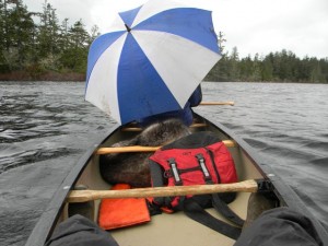
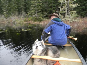
Our canoe trip was lovely – paddling through the quite of a blustery March afternoon, arousing the occasional Mallards and Canada Geese, but otherwise gliding unobtrusively through the dark brackish waters of this tidewater pond. The wind can be quite a force this close to the ocean, but that day it was not at its fiercest so we were spared the anguish of sore shoulders afterwards. The woods around this area are full of wildlife including a large population of black bears. One of our naturalist took the attached picture of a LARGE black bear he encountered on this property. Note the surprised  look in the bear’s eyes – that was pretty Close!

Afterward we also explored various access paths to Loomis Lake and we discovered that, aside from the Loomis Lake State Park entrance, which was closed – it was also possible to approach the lake from 206th avenue that dead ends at the water’s edge. We decided to save that excursion for another day…
Posted in Coastal Trails, Misc Trails & Trips, Pioneer Lore | 3 Comments